
International Maritime Routes and Sea Lanes
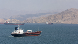
International maritime routes and sea lanes are the backbone of global trade, linking oceans, continents and major energy markets. Their importance is amplified at narrow chokepoints and strategic canals, where even small disruptions can affect shipping, fuel supplies and supply chains worldwide.
Major Global Maritime Chokepoints
- Strait of Hormuz: Situated between Oman and Iran, it connects the Persian Gulf with the Gulf of Oman and the Arabian Sea. It is the world’s most critical oil transit chokepoint, with average daily oil flow of over 20 million barrels.
- Strait of Malacca: Located between Indonesia, Malaysia and Singapore, it links the Indian Ocean to the South China Sea. It is the shortest sea route between the Persian Gulf and East Asian markets and carries about one-fourth of global maritime trade.
- Bab-el-Mandeb: Positioned between Yemen on the Arabian Peninsula and Djibouti and Eritrea in the Horn of Africa, it connects the Red Sea to the Gulf of Aden. It is a critical link in the maritime corridor between Europe and Asia.
- Strait of Gibraltar: Separating Spain and Morocco, this 14-kilometre-wide strait connects the Atlantic Ocean to the Mediterranean Sea and handles dense commercial shipping traffic.
- Turkish Straits: The Bosporus and Dardanelles separate Asian Turkey from European Turkey. The Bosporus connects the Black Sea to the Sea of Marmara, while the Dardanelles links the Sea of Marmara to the Aegean Sea.
Strategic Canal Routes
- Suez Canal: Opened in 1869, this 193-kilometre sea-level waterway in Egypt connects the Mediterranean Sea to the Red Sea.
- Convention of Constantinople (1888): It guarantees the right of passage for all ships through the Suez Canal during war and peace.
- Panama Canal: Completed in 1914, this 82-kilometre artificial waterway uses a system of locks to lift ships 26 metres to Gatun Lake, connecting the Atlantic and Pacific oceans.
- Torrijos-Carter Treaties (1977): They transferred canal control from the United States to Panama on December 31, 1999.
- Kiel Canal: Situated in Germany, this 98-kilometre canal connects the North Sea at Brunsbüttel to the Baltic Sea at Kiel-Holtenau, bypassing the longer route around the Jutland Peninsula.
Arctic Maritime Routes
- Northern Sea Route (NSR): It runs along Russia’s Arctic coast from the Kara Gate to the Bering Strait.
- Route advantage: The NSR lies entirely within Arctic waters and can reduce the maritime distance between East Asia and Northwestern Europe by up to 40% compared with the Suez Canal route.
- Northwest Passage (NWP): It traverses the Arctic Archipelago of Canada, connecting the Atlantic and Pacific oceans.
- Legal dispute: Canada considers these waters internal historic waters, while the United States and several European nations view them as an international strait.
- Transpolar Sea Route (TSR): This theoretical route crosses the centre of the Arctic Ocean and bypasses the exclusive economic zones of Arctic coastal states.
- Climate factor: The TSR is navigable only by heavy icebreakers at present, but may open further because of melting polar ice.
International Maritime Law and Institutions
- UNCLOS: The United Nations Convention on the Law of the Sea was adopted in 1982 and entered into force in 1994. It defines maritime zones and rules for passage.
- Territorial Sea: It extends up to 12 nautical miles from the baseline, where the coastal state exercises full sovereignty, subject to the right of innocent passage.
- Contiguous Zone: It extends up to 24 nautical miles from the baseline, allowing enforcement of customs, fiscal, immigration and sanitary laws.
- Exclusive Economic Zone (EEZ): It extends up to 200 nautical miles and grants sovereign rights over natural resource exploration and conservation.
- Transit passage: Unlike innocent passage, it applies to international straits such as Malacca and Hormuz and allows continuous and expeditious transit for foreign ships and aircraft.
- International Maritime Organization (IMO): A specialized agency of the United Nations established in 1948, it regulates shipping safety, security and environmental performance through treaties such as MARPOL and SOLAS.
Key Prelims Takeaways
- Strait of Hormuz: It is bordered by Iran and Oman and is a major oil chokepoint.
- Narrowest point: The Strait of Hormuz is about 39 kilometres wide at its narrowest point.
- Turkish Straits: The Montreux Convention of 1936 regulates naval transit through the Bosporus and Dardanelles.
- Suez Canal: It is owned and operated by the state-owned Suez Canal Authority of Egypt.
- UNCLOS and sovereignty: Coastal states have full sovereignty over the Territorial Sea, but foreign vessels retain the right of innocent passage.
- MARPOL: The International Convention for the Prevention of Pollution from Ships is the primary treaty on marine pollution from ships.
Recent Context
Russia began the first oil transport through the Vostok Oil trunk pipeline on September 5, 2026, with crude loaded at the Sever Bay terminal in Krasnoyarsk Krai. The project, led by Rosneft, is linked to Arctic energy transport and the Northern Sea Route, with cargo traffic on the route projected to rise sharply by 2030.
The first-stage pipeline connects the Vankor cluster and the Payakha group fields to the coastal terminal. The initial cargo was loaded onto Valentin Pikul, a high-ice-class Arctic shuttle tanker.
| Related | |
|---|---|



Krishna Salian
September 7, 2026 at 5:06 amThanks for the article on International Maritime Routes and Sea Lanes. It’s an excellent article and worth reading. It gives a broad view of the sea routes and lanes just as we have for road transport, railways and air routes. While referring to the article, one can visualize how the future global trade will operate. Such articles are always welcome.