Major International Trade Corridors
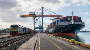
Cross-border trade corridors are integrated transport networks that link production centres, ports, and markets across countries. They improve connectivity, reduce transit time, and support logistics, customs coordination, and regional integration.
Understanding Cross-Border Corridors
Cross-border corridors are integrated networks of infrastructure that connect trade hubs, countries, and continents. These networks include roads, railways, ports, airports, pipelines, and digital cables. Depending on their operational scale and integration levels, cross-border corridors fall into three main types.
Classification of Cross-Border Corridors
| Corridor Type | Primary Focus | Transport Mode | Complexity | Key Example |
| Transport Corridor | Physical pathways and connectivity | Basic unimodal or road/rail | Low | India-Myanmar-Thailand Trilateral Highway |
| Transit Corridor | Customs alignment and administrative ease | Multimodal or unimodal | Medium | TIR Convention corridors |
| Trade Corridor | Logistics, warehousing, and supply chains | Integrated multimodal | High | Northern Sea Route |
India-Middle East-Europe Economic Corridor (IMEC)
Launched during the G20 Summit in New Delhi in September 2023, the India-Middle East-Europe Economic Corridor is a multi-modal transit initiative. It is part of the G7 Partnership for Global Infrastructure and Investment (PGII). The corridor offers a transparent and debt-free alternative to China’s Belt and Road Initiative (BRI).
Key Features of IMEC
- Participating Members: India, the United States, Saudi Arabia, the United Arab Emirates, the European Union, France, Germany, and Italy signed the initial Memorandum of Understanding (MoU).
- Two Interconnected Segments: The Eastern Corridor connects ports on the west coast of India to the Arabian Gulf. The Northern Corridor connects the Arabian Gulf to Europe through rail and sea networks.
- Multimodal Components: The route combines container shipping and rail networks. It incorporates electricity grids, high-speed digital data cables, and green hydrogen pipelines.
- Expected Benefits: It reduces logistics costs by up to 30%. It shortens cargo transit times by 40% compared to the traditional maritime route via the Suez Canal.
- Key Maritime Ports: The project connects major Indian ports like Mumbai, Kandla, and Kochi with Middle Eastern hubs such as Jebel Ali (UAE) and Dammam (Saudi Arabia), and European ports like Piraeus (Greece).
International North-South Transport Corridor (INSTC)
The International North-South Transport Corridor is a 7,200-kilometer-long multimodal network. It provides a direct transit link connecting India with Russia and Central Asia. The corridor bypasses the traditional, longer maritime route through the Suez Canal.
Structural Details of INSTC
- Member Countries: The founding members are India, Iran, and Russia. Today, the network includes eleven other nations: Armenia, Azerbaijan, Belarus, Kazakhstan, Kyrgyzstan, Oman, Syria, Tajikistan, Turkey, and Ukraine.
- Core Route: Cargo moves by sea from the Port of Mumbai (India) to the Bandar Abbas and Chabahar ports (Iran). It travels overland across Iran to the Caspian Sea coast, continues by sea to Astrakhan (Russia), and moves by rail across Russia to Moscow and Northern Europe.
- Time and Cost Reductions: INSTC reduces total transit time from 40 days to approximately 20-25 days. It reduces freight transit costs by nearly 30%.
- The Baku Route: An overland rail corridor passes through Azerbaijan to link the Iranian rail network directly with Russia, reducing dependency on Caspian Sea shipping.
Trans-Caspian International Transport Route (Middle Corridor)
The Middle Corridor is an overland and maritime trade route. It links China and East Asia to Europe through Central Asia and the South Caucasus, entirely bypassing Russian territory. It serves as an alternative to the Northern Corridor which passes through Russia and Belarus.
Operational Route of the Middle Corridor
- The Pathway: The route begins in China and travels through Kazakhstan by rail. It crosses the Caspian Sea via cargo ferries to the Port of Baku in Azerbaijan. It then crosses Azerbaijan and Georgia by rail to Turkish ports or European rail networks.
- Participating Nations: Azerbaijan, Georgia, Kazakhstan, and Turkey signed foundational agreements to coordinate tariffs and border clearance procedures.
- Transit Capacity: Cargo volume along this route increased after geopolitical tensions in Eastern Europe disrupted the Northern Corridor. Transit times between China and Europe average 12 to 15 days.
- Key Infrastructure: The Baku-Tbilisi-Kars (BTK) railway is a critical segment of this corridor, linking the South Caucasus directly with Turkey’s national rail system.
China-Pakistan Economic Corridor (CPEC)
The China-Pakistan Economic Corridor is a 3,000-kilometer-long infrastructure project. It is a major component of China’s Belt and Road Initiative (BRI). The corridor links southwestern Pakistan directly with northwestern China.
Key Components of CPEC
- Connected Hubs: It connects the deep-water port of Gwadar in Balochistan, Pakistan, to the Xinjiang Uygur Autonomous Region in China through the Karakoram Highway.
- Infrastructure Scope: The project includes a network of highways, expressways, optical fiber cables, coal-fired and hydroelectric power plants, and Special Economic Zones (SEZs).
- Strategic Access: CPEC allows China direct access to the Arabian Sea. It shortens the import route for crude oil from the Persian Gulf, bypassing the Strait of Malacca.
- Territorial Stance: Certain nations object to CPEC because the route passes through Pakistan-occupied Kashmir (PoK), violating territorial sovereignty.
Lobito Corridor
The Lobito Corridor is a transport and logistics network in Southern Africa. Backed by the G7 Partnership for Global Infrastructure and Investment, the United States, and the European Union, it is a key Western project designed to secure access to critical minerals.
Key Elements of the Lobito Corridor
- Route Alignment: It stretches 1,300 kilometers from the Atlantic deep-water Port of Lobito in Angola through the mineral-rich Katanga province of the Democratic Republic of Congo (DRC) to the Copperbelt in Zambia.
- Primary Focus: The corridor facilitates the extraction and transport of critical battery minerals, specifically copper and cobalt, from Central Africa to Western markets.
- The Benguela Railway: The central axis of the corridor is the rehabilitated Benguela railway, originally built in the early 20th century and later upgraded with international financing.
- Investment Partnerships: The African Development Bank (AfDB) and the Africa Finance Corporation (AFC) are major financial partners coordinating the expansion of this rail network.
Interoceanic Corridor of the Isthmus of Tehuantepec (CIIT)
The Interoceanic Corridor of the Isthmus of Tehuantepec is a land-based transit corridor in Southern Mexico. It connects the Pacific and Atlantic Oceans. Designed as a “dry canal,” it provides an overland alternative to the Panama Canal.
Route and Infrastructure of CIIT
- The Pathway: The main rail corridor, Line Z, runs 303 kilometers across the narrowest strip of land in Mexico. It connects the Port of Coatzacoalcos in Veracruz (Gulf of Mexico) with the Port of Salina Cruz in Oaxaca (Pacific Ocean).
- Operational Capacity: Freight operations began in late 2023, transporting containers across the isthmus by rail in approximately six hours.
- Industrial Zones: The Mexican government designated 10 development parks along the route to attract manufacturing, wind energy, and logistics enterprises.
- Strategic Role: The dry canal serves as a contingency route during low-water crises in the Panama Canal and supports nearshoring activities for North American supply chains.
Regional and Niche Trade Corridors
In addition to major transcontinental corridors, nations develop localized cross-border corridors to improve regional integration and address geopolitical bottlenecks.
Kaladan Multi-Modal Transit Transport Project
- Route: Connects Kolkata Port in India to the Sittwe deep-water port in Rakhine State, Myanmar, by sea. It then goes up the Kaladan River to Paletwa, and continues by road to Mizoram, India.
- Strategic Goal: It provides an alternative transit route to India’s landlocked Northeast region, bypassing the narrow and vulnerable Siliguri Corridor, also known as the “Chicken’s Neck”.
Secure Green Land Corridor (Oman-Saudi Arabia)
- Route: Launched in August 2026, this overland logistics corridor crosses the Rub’ al Khali (Empty Quarter) desert. It connects Sohar Port in Oman with dry-port facilities in Saudi Arabia’s Eastern Province.
- Strategic Goal: The corridor reduces transit times by allowing cargo trucks to bypass United Arab Emirates border checkpoints, establishing a direct link between the Gulf of Oman and the Saudi hinterland.
Bangladesh-China-India-Myanmar (BCIM) Economic Corridor
- Route: Conceived to connect Kolkata in India with Kunming in southwestern China, passing through Dhaka in Bangladesh and Mandalay in Myanmar.
- Strategic Goal: It aims to integrate a region containing over 400 million people. Progress remains slow due to geopolitical friction and border security issues.
Recent Context
In August 2026, Oman and Saudi Arabia activated the Secure Green Land Corridor, a direct overland freight route across the Rub’ al Khali. It links Sohar Port with Saudi dry-port facilities and improves bilateral logistics efficiency.
Rare Facts for Prelims
- Rub’ al Khali: It is the world’s largest continuous sand desert and spans four countries.
- BTK Railway: The Baku-Tbilisi-Kars line is a key rail link that helps move cargo between the Caspian region and Turkey.
- INSTC: The corridor was designed to cut dependence on the Suez Canal for India-Europe trade.
- CIIT: Mexico’s Tehuantepec corridor is often described as a “dry canal” because it links two oceans by land.
- Lobito Corridor: The corridor is especially important for copper and cobalt supply chains used in batteries and clean energy technologies.
- CPEC: Gwadar gives China a shorter route to the Arabian Sea, reducing reliance on the Strait of Malacca.
| Related | |
|---|---|