India State of Forest Report: Methodology and Indicators
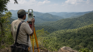
The Indian State of Forest Report is the standard national reference for assessing forest and tree resources in India. Published by the Forest Survey of India (FSI), it combines satellite imagery, field checks and inventory methods to track forest cover, carbon stock and related ecological indicators.
For Prelims, the report is important because it explains how forest cover is defined, classified and measured, and how India’s official forest statistics are compiled for policy and international reporting.
Forest Survey of India: Structure and Mandate
- Establishment: FSI was founded on 1 June 1981, succeeding the Pre-Investment Survey of Forest Resources (PISFR), which began in 1965 with FAO and UNDP assistance.
- Headquarters: Dehradun, Uttarakhand.
- Regional offices: Shimla (Northern Zone), Kolkata (Eastern Zone), Nagpur (Central Zone) and Bengaluru (Southern Zone).
- Nodal ministry: It functions as an attached office under the Ministry of Environment, Forest and Climate Change (MoEFCC).
- Key mandate: FSI prepares the biennial Indian State of Forest Report and conducts the National Forest Inventory (NFI) in forest and non-forest areas.
- Other functions: It monitors forest fires through satellite-based near real-time monitoring, maps forest canopy density, mangroves and coral reef ecosystems, and trains forestry personnel in remote sensing, GIS and field inventory.
Indian State of Forest Report: Nature and Purpose
- Biennial assessment: The report is published every two years.
- First edition: It was first published in 1987.
- Major uses: The report provides the baseline for national environmental policy, monitoring ecological targets under the National Forest Policy, and reporting to international bodies such as the Food and Agriculture Organization (FAO).
- What it tracks: The report covers forest cover, tree cover, mangrove cover, growing stock and carbon stock.
- Policy value: It is the official source for understanding trends in India’s green cover and forest resources over time.
Methodology of Forest Cover Assessment
- Core approach: FSI uses a combination of satellite remote sensing, Geographic Information System (GIS) techniques and ground truth verification.
- Satellite source: Indian Remote Sensing (IRS) data is used for the assessment.
- Recent sensors: Recent editions rely on LISS-III (Linear Imaging Self-Scanning Sensor) aboard IRS-P6 (Resourcesat-1) and Resourcesat-2 satellites.
- Spatial resolution: The imagery is used at 23.5 metres spatial resolution.
- Scale of mapping: Mapping is done at 1:50,000 scale.
- Minimum Mapping Unit (MMU): The MMU is 1 hectare. Patches smaller than 1 hectare are not counted as forest cover even if they have more than 10% canopy; they may be treated as tree cover.
- Ground verification: Remote sensing interpretation is checked through field verification at selected geographic coordinates.
- Quality check: An error matrix is used to assess accuracy, with an overall accuracy target above 85%.
Forest Cover Classification
- Very Dense Forest (VDF): Lands with tree canopy density of 70% and above.
- Moderately Dense Forest (MDF): Lands with tree canopy density between 40% and 70%.
- Open Forest (OF): Lands with tree canopy density between 10% and 40%.
- Scrub: Forest lands with tree canopy density below 10%; these are degraded forest lands and are not included in total forest cover.
- Non-forest: All lands not falling in the above classes, including water bodies, agriculture and habitations.
Exam point: Forest cover means land above 1 hectare with tree canopy density of more than 10%, regardless of ownership or legal status.
Key Indicators: Forest Cover, RFA, Tree Cover and Carbon Stock
- Forest cover: Includes all lands larger than 1 hectare with canopy density above 10%, irrespective of legal ownership. It may include orchards, bamboo and palms.
- Recorded Forest Area (RFA): Refers to land recorded as forest in government records, including Reserved Forests, Protected Forests and Unclassed Forests under the Indian Forest Act, 1927 or state laws.
- Tree cover: Refers to tree patches smaller than 1 hectare, including isolated trees, located outside recorded forest areas.
- Trees Outside Forests (TOF): Trees found outside recorded forest areas, such as linear plantations along roads, canals, farmland and urban parks.
- Growing stock: Total volume of all living trees above a specified minimum diameter at breast height (DBH) in a given area.
- Forest carbon stock: Total carbon stored in forest ecosystems, assessed across five pools.
- Above-Ground Biomass (AGB): Living vegetation above the soil, including stems, branches, bark and foliage.
- Below-Ground Biomass (BGB): Living roots of trees and woody plants.
- Dead wood: Non-living woody biomass excluding litter.
- Litter: Non-living biomass of dead leaves, twigs and small woody debris above the soil.
- Soil Organic Carbon (SOC): Organic carbon in mineral and organic soils to a specified depth; this is the largest component of India’s forest carbon pool.
Evolution of the ISFR Methodology
- 1987: The first assessment was based on visual interpretation of Landsat satellite imagery at 1:1,000,000 scale.
- 1995: The report shifted from visual interpretation to digital image processing.
- 2002: A grid-based National Forest Inventory introduced a systematic sampling design for detailed field inventory.
- Recent editions: They include specialised chapters on bamboo resources, forest fire vulnerability zones, carbon stock modelling and climate change hot spots in forest areas.
Key Prelims Takeaways
- FSI: An attached office under MoEFCC, headquartered in Dehradun.
- ISFR frequency: Published biennially, first issued in 1987.
- Primary remote sensing source: LISS-III data from Resourcesat satellites.
- MMU: 1 hectare; smaller patches are treated differently from forest cover.
- Forest cover threshold: More than 10% canopy density on land above 1 hectare.
- RFA: Includes Reserved Forests, Protected Forests and Unclassed Forests in official records.
- Largest forest carbon pool component: Soil Organic Carbon (SOC).
Current General Studies comprises current-affairs-based, General Studies-rich study material on policies, laws, institutions, economy, science, environment, governance, international relations, and other varied but important topics for UPSC and State PSC Prelims examinations.
Fortnightly PDF compilations: Available here
Originally written on
May 7, 2026
and last modified on
September 6, 2026.
| Related | |
|---|---|