Types of Satellite Imaging Systems
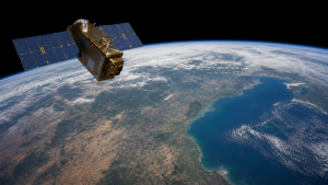
Satellite imaging systems are the backbone of modern Earth observation. By capturing reflected or emitted electromagnetic radiation, they generate usable data for agriculture, climate studies, resource mapping, disaster response, governance, and strategic surveillance.
Optical and Panchromatic Imaging
- Optical remote sensing works mainly in the visible, near-infrared (NIR) and shortwave infrared (SWIR) regions of the electromagnetic spectrum, broadly covering 0.4 to 2.5 micrometers.
- Panchromatic sensors collect reflected light in a single broad band across the visible spectrum and produce high-spatial-resolution grayscale images.
- Pan-sharpening combines high-resolution panchromatic data with lower-resolution multispectral data to create sharper colour imagery.
- Passive sensing is the main feature of optical systems: they depend on sunlight, so imaging is limited to daytime and cloud-free conditions.
- Spatial resolution refers to the smallest ground object a sensor can distinguish. High-resolution satellites may achieve sub-meter detail, while meteorological systems often have resolution above 30 metres.
- NIR is especially useful for vegetation studies because healthy plants reflect strongly in this band, making it valuable for crop and forest assessment.
Multispectral and Hyperspectral Imaging
- Multispectral imaging captures data in a few widely spaced bands and is widely used for broad land-cover classification.
- Systems such as India’s Resourcesat and the US Landsat series are examples of multispectral Earth observation platforms.
- Hyperspectral imaging records continuous spectral information across hundreds of narrow, contiguous bands.
- Because hyperspectral data captures detailed spectral signatures, it can help identify specific minerals, chemical composition, plant stress, and contamination.
- It is particularly useful for analysing crop diseases, soil nutrient content, plant species differences, and mineral exploration.
- The main trade-off is volume and complexity: hyperspectral systems produce much larger datasets and require advanced processing.
| Parameter | Multispectral Imaging | Hyperspectral Imaging |
| Number of bands | 3 to 15 discrete bands | Tens to hundreds of contiguous narrow bands |
| Band width | Broad, usually 50 to 200 nanometers | Narrow, usually 5 to 20 nanometers |
| Spectral resolution | Moderate | Extremely high |
| Best use | Broad classes such as water, vegetation and soil | Specific chemical and mineral identification |
| Data volume | Low to moderate | High, with heavier processing needs |
Synthetic Aperture Radar (SAR) Systems
- SAR is an active remote sensing technology: it transmits microwave signals and measures the backscatter returned from the Earth’s surface.
- It operates in the microwave spectrum, with wavelengths roughly from 1 centimetre to 1 metre.
- Because microwaves can penetrate clouds, haze, dust, heavy rain and even some canopy cover, SAR works in almost all weather conditions.
- Day-and-night imaging makes SAR especially valuable for flood mapping, glacier monitoring, topographic mapping and national security applications.
- The sensor uses the motion of the spacecraft to synthesize a very large antenna, which improves resolution from orbit.
- Different SAR bands are used for different tasks: X-band supports high-resolution imaging, C-band is useful for agriculture, and L-band offers better canopy penetration.
Exam fact: SAR is the key active satellite imaging system, while optical, multispectral and hyperspectral sensors are passive systems.
SWIR and Thermal Remote Sensing
- SWIR sensors capture light in the 1.4 to 3.0 micrometer range and are highly sensitive to moisture and chemical bonds.
- SWIR imaging can penetrate atmospheric haze, smoke and thin clouds, which makes it useful in wildfire monitoring, mineral mapping and crop water-stress studies.
- Thermal infrared (TIR) sensors detect emitted thermal radiation rather than reflected sunlight.
- TIR usually operates in the 8 to 14 micrometer range and is used to measure surface temperature.
- Common applications include urban heat island mapping, volcanic monitoring, geothermal studies and tracking industrial thermal discharge.
- SWIR vs NIR: NIR is useful mainly for vegetation chlorophyll mapping, while SWIR is better for detecting liquid water content in plants and soils.
Key Prelims Takeaways
- Passive vs active sensors: Optical, multispectral and hyperspectral systems depend on solar radiation, while SAR generates its own signal.
- Ground Sampling Distance (GSD): This is the distance between pixel centres on the ground; smaller GSD means finer spatial detail.
- Spectral signature: The unique pattern of reflection and absorption of an object across wavelengths helps identify materials.
- Optical systems: They are highly useful for land-use mapping, but cloud cover remains a major limitation.
- Hyperspectral advantage: It can distinguish specific chemical and mineral signatures, making it important for precision agriculture and mineral exploration.
- SAR advantage: It can image during day or night and through cloud cover, supporting disaster response and surveillance.
- Governance angle: Satellite imaging supports evidence-based planning, border monitoring, infrastructure assessment and technology regulation debates around remote sensing data.
Recent Context
Pixxel, a Bengaluru-based space-tech startup, closed a USD 100 million Series C funding round on September 7, 2026. The company operates six Firefly satellites with hyperspectral imaging in the 5.5-metre class, and plans to expand manufacturing, add SAR and high-resolution optical systems, and launch its SWIR-focused Honeybee constellation from 2027.
| Related | |
|---|---|