Space Situational Awareness Concepts, Systems and Providers
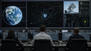
Space Situational Awareness (SSA), also called Space Domain Awareness (SDA) in defence usage, is the continuous monitoring of objects in space to detect, track, identify and characterise them. It helps operators assess collision risk, manage orbital traffic and support safe, sustainable use of space.
As satellites, rocket bodies and debris multiply across orbit regimes, SSA has become a core capability for governments, military agencies and commercial operators. It combines sensors, data fusion and prediction tools to support conjunction assessment and orbital safety.
Understanding Space Situational Awareness
- Core function: SSA continuously tracks active satellites, inactive spacecraft, spent rocket stages and fragmented debris.
- Orbital domains: Monitoring covers Low Earth Orbit (LEO), Medium Earth Orbit (MEO) and Geostationary Orbit (GEO).
- Technical inputs: It uses optical telescopes, radar networks and laser ranging systems.
- Operational output: The data is used to calculate collision probabilities and conduct conjunction assessments.
- Strategic need: The rapid growth of satellites and orbital debris has made coordinated monitoring essential.
The global SSA systems market was valued at about USD 1.7 billion to USD 1.83 billion in 2025 and is projected to rise to around USD 2.4 billion to USD 3 billion by the early 2030s. The growth is linked to mega-constellations, orbital congestion and increasing demand for space safety services.
U.S. Programs and Tracking Networks
- DARC (ST-25): The Deep Space Advanced Radar Capability achieved Early Use capability for U.S. Space Command in September 2025.
- Location: DARC is operated out of the Integrated Radar Operations Center at Eglin Air Force Base.
- Expansion: In August 2026, Northrop Grumman received a USD 215.9 million contract modification for antenna hardware and long-lead items for DARC Site 2.
- Timeline: Site 2 completion is projected by March 30, 2030.
- TraCSS: The Traffic Coordination System for Space is managed by the NOAA Office of Space Commerce.
- User access: TraCSS began accepting satellite owner/operator registrations and national government accounts in early 2026.
- Budget issue: The proposed U.S. federal budget for fiscal year 2027 requests USD 11 million for the Office of Space Commerce, down from USD 52.5 million enacted for fiscal year 2026.
The funding cut has raised concerns in Congress about the continuity of TraCSS operations and the U.S. transition toward a more civil, commercially oriented space traffic coordination model.
European Union Capabilities
- EU SST: The European Union Space Surveillance and Tracking capability completed 10 years of operations on July 1, 2026.
- Sensor network: It protects more than 690 satellites using around 70 operational sensors across member states.
- Front Desk: The European Union Agency for the Space Programme (EUSPA) manages the EU SST Front Desk from Madrid.
- Services: EUSPA handles service delivery, safety alerts and fragmentation analysis.
- Membership: The partnership currently includes 19 member states.
- EU Space Act: The draft European Union Space Act, proposed by the European Commission in June 2025, remains under review.
The EU model emphasises shared infrastructure and autonomy in space operations, while debates continue on national security exemptions, dual-use provisions and possible overlap with national rules.
India’s SSA Framework and NETRA
- IS4OM: The ISRO System for Safe and Sustainable Space Operations Management is India’s nodal entity for space sustainability.
- Assessment report: IS4OM published the Indian Space Situational Assessment Report for 2025 in April 2026.
- Purpose: The report tracks regional collision risks and supports safer orbital operations.
- Project NETRA: The Network for Space Objects Tracking and Analysis is India’s SSA initiative for indigenous tracking capability.
- Facilities under NETRA: It includes an optical telescope at Hanle, Ladakh, and a tracking radar at Chandrapur, Assam.
- Objective: These systems aim to reduce dependence on foreign sensor data.
- DFSM: The Debris Free Space Mission, launched in 2024, targets zero debris creation by all government and private Indian space actors by 2030.
Commercial and Private Space Security
- LeoLabs Scout-S: The company deployed its first transportable, modular S-band 3D search radar system in Hawaii in June 2026.
- U.S. contract: In August 2026, LeoLabs secured a USD 20.7 million contract from the U.S. Space Force for mobile variants of Scout-S.
- Tracking capability: The radar is intended to track space assets and uncooperative objects down to centimetre size.
- LeoLabs Delta: Launched in April 2026, it replaced the earlier LeoGuard platform.
- Function: The platform uses artificial intelligence for threat detection and object characterisation.
- Startups: Munich-based Project-S emerged from stealth on September 2, 2026, to develop space-based active radar payloads and software for sub-centimetre orbital debris.
Key Prelims Takeaways
- SSA/SDA: Continuous monitoring of space objects to detect, track, identify and characterise them.
- Key sensors: Optical telescopes, radar networks and laser ranging systems are widely used in SSA.
- IS4OM: ISRO’s nodal entity for safe and sustainable space operations management.
- Project NETRA: India’s tracking initiative with facilities at Hanle and Chandrapur.
- DFSM: India’s Debris Free Space Mission aims for zero debris creation by 2030.
- TraCSS: NOAA’s Traffic Coordination System for Space for satellite traffic coordination.
- EU SST: Europe’s shared surveillance capability, managed through EUSPA’s Front Desk in Madrid.
- DARC (ST-25): A U.S. deep space radar capability for tracking objects in deep space.
| Related | |
|---|---|