
Major Rivers of India and Their Tributary Systems
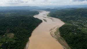
India’s river systems are commonly studied through their origin, flow regime, and drainage pattern. For Prelims, the most useful facts are the source, major tributaries, basin spread, and whether a river is Himalayan or Peninsular.
Himalayan rivers are generally perennial and glacier-fed, while Peninsular rivers are mostly rain-fed and seasonal. Their tributary systems, basin sizes, and discharge directions are repeatedly asked in geography-based questions.
Classification of Indian River Systems
- By origin: Himalayan rivers are antecedent in nature and cut deep gorges through young mountain ranges, while Peninsular rivers are consequent and flow along the general slope of the plateau.
- By discharge location: The Arabian Sea drainage includes the Indus, Narmada, Tapi, Mahi and Sabarmati systems.
- By discharge location: The Bay of Bengal drainage includes the Ganga, Brahmaputra, Godavari, Krishna, Mahanadi and Cauvery systems.
- By runoff share: About 23% of India’s surface run-off drains into the Arabian Sea, while nearly 77% flows into the Bay of Bengal.
- Himalayan rivers: These are fed by snowmelt and rainfall, and usually form deep valleys, gorges and meanders across the northern plains.
- Peninsular rivers: These are mostly non-perennial, rain-fed, and flow through older, more graded valleys.
The Indus River System
- Length and extent: The Indus river system is one of the largest transboundary basins in the world, with a total length of about 2,880 km; 1,114 km lie within India.
- Origin: It rises near the Bokhar Chu glacier in the Kailash range close to Lake Manasarovar in Tibet, where it is known as Singi Khamban.
- Course: It flows northwest through Ladakh and Jammu and Kashmir before entering Pakistan near Chillar in the Dardistan region.
- Geographical feature: The river passes between the Karakoram and Zanskar ranges and cuts a gorge at Attock.
- Left-bank tributaries: Zanskar, Suru, Soan and Panjnad.
- Right-bank tributaries: Shyok, Nubra, Gilgit, Hunza, Kabul, Swat, Kurram, Tochi and Gomal.
- Jhelum: It rises at the Verinag spring in Jammu and Kashmir, flows through Wular Lake, and meets the Chenab at Trimmu in Pakistan.
- Chenab: Formed by the confluence of the Chandra and Bhaga rivers at Tandi in Himachal Pradesh, it is the largest tributary of the Indus.
- Ravi: It originates near Rohtang Pass in the Kullu hills and flows between the Pir Panjal and Dhauladhar ranges.
- Beas: It originates from Beas Kund near Rohtang Pass, remains entirely within India, and meets the Sutlej at Harike in Punjab.
- Sutlej: It rises at Rakshas Tal near Manasarovar in Tibet, where it is known as Langqên Zangbo, and enters India through Shipki La.
The Ganga River System
- Basins: The Ganga basin is the largest river basin in India, covering about 8.6 lakh sq km across eleven states.
- Formation: The river is formed at Devprayag by the confluence of the Bhagirathi and Alaknanda.
- Bhagirathi: It originates at Gaumukh from the Gangotri glacier.
- Alaknanda: It originates from the Satopanth glacier.
- Panch Prayag: Vishnuprayag is the confluence of Alaknanda and Dhauliganga; Nandaprayag of Alaknanda and Nandakini; Karnaprayag of Alaknanda and Pindar; Rudraprayag of Alaknanda and Mandakini; Devprayag of Alaknanda and Bhagirathi.
- Left-bank tributaries: Ramganga, Garra, Gomti, Ghaghara, Gandak, Burhi Gandak, Kosi and Mahananda.
- Right-bank tributaries: Yamuna, Son and Punpun.
- Yamuna: It rises at the Yamunotri glacier on the Banderpunch range.
- Yamuna tributaries: Its right-bank tributaries include Chambal, Sind, Betwa and Ken, while its left-bank tributaries include Tons, Hindon and Rind.
- Ghaghara: It rises in the Mapchachungo glacier in Tibet, receives the Sharda (Saryu) and Rapti, and joins the Ganga at Chhapra.
- Gandak: It comprises the Kaligandak and Trishulganga streams, enters the plains at Triveni, and meets the Ganga at Sonpur.
- Kosi: Also called Saptakoshi, it is known for shifting its course; its chief stream Arun originates in Tibet.
The Brahmaputra River System
- Character: The Brahmaputra is a major transboundary river noted for high discharge, heavy sediment load and frequent channel shifting.
- Origin: It rises in the Chemayungdung glacier of the Kailash range south of Lake Manasarovar in Tibet.
- Upper course: It flows eastward for about 1,200 km in Tibet under the name Yarlung Tsangpo.
- Gorge and entry into India: It cuts a deep gorge around Namcha Barwa and enters Arunachal Pradesh near Pasighat as the Siang or Dihang.
- Confluence: The Siang/Dihang joins the Dibang and Lohit at Sadiya to form the Brahmaputra.
- Course in Bangladesh: It enters Bangladesh near Dhubri as the Jamuna, meets the Ganga (Padma), and finally discharges into the Bay of Bengal as the Meghna.
- Left-bank tributaries: Dibang, Lohit, Burhi Dihing and Dhansiri (South).
- Right-bank tributaries: Subansiri, Kameng (Jiabhareli), Manas, Sankosh and Teesta.
- Majuli: It is the world’s largest mid-stream riverine island and lies on the Brahmaputra in Assam.
Peninsular East-Flowing Rivers
- General pattern: East-flowing Peninsular rivers drain into the Bay of Bengal and build extensive deltaic deposits along the Coromandel and Northern Circars coasts.
- Godavari: The largest Peninsular river system, often called the Dakshin Ganga or Gautami, it rises at Trimbakeshwar in Nashik district, Maharashtra.
- Godavari tributaries: Left-bank tributaries include Penganga, Wainganga, Wardha, Pranhita, Indravati and Sabari.
- Godavari tributaries: Right-bank tributaries include Manjira, Pravara and Peddavagu.
- Krishna: The second-largest east-flowing Peninsular river, it originates near Mahabaleshwar in the Western Ghats.
- Krishna tributaries: Left-bank tributaries include Bhima, Musi, Munneru and Dindi.
- Krishna tributaries: Right-bank tributaries include Koyna, Ghataprabha, Malaprabha and Tungabhadra.
- Mahanadi: It rises at Sihawa in Dhamtari district of Chhattisgarh; important tributaries include Seonath, Hasdeo, Mand and Ib on the left bank, and Jonk, Tel and Ong on the right bank.
- Cauvery: It rises at Talakaveri in the Brahmagiri range of Karnataka; important tributaries include Hemavati, Harangi, Arkavathi, Shimsha and Bhavani.
Key Prelims Takeaways
- Himalayan rivers: Perennial, snow-fed and rain-fed; they usually form deep gorges and wide meanders.
- Peninsular rivers: Mostly seasonal, rain-fed and older in geological age.
- Drainage division: Nearly 77% of India’s surface run-off goes to the Bay of Bengal and about 23% to the Arabian Sea.
- Largest basin: The Ganga basin is the largest in India.
- Largest Peninsular basin: The Godavari system is the largest Peninsular river system.
- River origin facts: Indus, Sutlej, Bhagirathi, Alaknanda, Yamuna and Brahmaputra are frequently asked for source locations.
- Island fact: Majuli on the Brahmaputra is the world’s largest mid-stream riverine island.
Current General Studies comprises current-affairs-based, General Studies-rich study material on policies, laws, institutions, economy, science, environment, governance, international relations, and other varied but important topics for UPSC and State PSC Prelims examinations.
Fortnightly PDF compilations: Available here
Originally written on
May 24, 2026
and last modified on
September 6, 2026.
| Related | |
|---|---|



Deb Bandyopadhyay
July 23, 2023 at 9:15 amVery knowledgable articles.