Important Himalayan Passes and Trans-Himalayan Routes
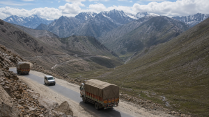
The Himalayan and Trans-Himalayan passes have long served as vital links for trade, travel, border movement, and strategic connectivity across some of the world’s highest mountain terrain.
Key Passes in Ladakh and Jammu & Kashmir
Khardung La
- Location: On the Ladakh Range, north of Leh.
- Importance: Main gateway to the Shyok and Nubra valleys.
- Strategic value: Provides access toward the Siachen Glacier area.
- Historical role: Once an active caravan route connecting Leh with Yarkand in Central Asia.
Zoji La
- Location: In the Zanskar Range at an elevation of 3,528 metres.
- Connectivity: Links the Kashmir Valley (Srinagar) with Ladakh (Kargil and Leh).
- Weather impact: Heavy winter snow often blocks the pass for several months each year.
- Infrastructure: The Zoji La Tunnel is being built beneath the pass to reduce seasonal closures.
Karakoram Pass
- Location: On the Karakoram Range along the border between Ladakh and Xinjiang, China.
- Historical route: Lies on an ancient branch of the Silk Route.
- Altitude: One of the highest passes in India, at over 5,500 metres.
- Terrain: Extremely harsh climate with little or no vegetation.
Banihal Pass
- Location: On the Pir Panjal Range in Jammu & Kashmir.
- Connectivity: Connects the Jammu region with the Kashmir Valley.
- Transport link: The Jammu-Srinagar National Highway passes through the Jawahar Tunnel under this pass.
- Modern route: The Banihal-Qazigund road tunnel provides all-weather passage.
Pir Panjal Pass
- Location: On the Pir Panjal Range.
- Connectivity: Links Jammu with Rajouri and Poonch.
- Historical importance: Used during the Mughal period and often called the Mughal Road.
Other Important Western Passes
- Aghil Pass: North of the K2 peak in the Karakoram Range; connects Ladakh with Xinjiang, China.
- Chang La: In the Ladakh Range; connects Leh with the Changthang plateau and Tibet.
- Fotu La: On the Zanskar Range on the Srinagar-Leh highway; the highest point on this road route.
- Imis La: A high-altitude pass connecting Ladakh with Tibet.
Passes of Himachal Pradesh
Himachal Pradesh shares borders with Tibet and Ladakh, and its passes connect the green southern valleys with the cold, dry high-altitude regions to the north.
Rohtang Pass
- Location: On the eastern Pir Panjal Range.
- Connectivity: Links the Kullu Valley with the high-altitude Lahaul and Spiti valleys.
- Geographical significance: Lies on the watershed between the Chenab and Beas river basins.
- Modern route: The Atal Tunnel bypasses the pass for all-weather traffic.
Bara-Lacha La
- Location: At an elevation of 4,890 metres on the Zanskar Range.
- Connectivity: Links the Lahaul district of Himachal Pradesh with Ladakh.
- Water divide: Acts as a divide between the Bhaga River and the Yunam River.
- Highway link: The Leh-Manali Highway passes through this mountain saddle.
Shipki La
- Location: In the Sutlej Gorge on the India-China border.
- Connectivity: Links Himachal Pradesh with Tibet.
- River route: The Sutlej River enters India from Tibet through this gorge.
- Trade importance: One of the three designated border trade posts between India and China.
Debsa Pass
- Location: On the Spiti-Kullu divide.
- Connectivity: Links the Kullu Valley with the Spiti Valley.
- Route value: Serves as an alternative to the Pin Parvati Pass.
Passes of Uttarakhand
The passes of Uttarakhand lie in the Greater Himalayas and connect the Garhwal and Kumaon regions with Tibet.
Lipulekh Pass
- Location: In the tri-junction area of India (Uttarakhand), Nepal, and China (Tibet).
- Pilgrimage route: The main land route for pilgrims heading to Mount Kailash and Lake Manasarovar.
- Trade role: A key border trading post between India and China.
Mana Pass
- Location: In the Greater Himalayas near the Badrinath temple.
- Connectivity: Links Uttarakhand with Tibet.
- Altitude: One of the highest vehicle-accessible passes in the world.
- River source: The Saraswati River, a tributary of the Alaknanda, originates near this pass.
Niti Pass
- Connectivity: Links the Garhwal region of Uttarakhand with Tibet.
- Seasonal condition: Remains snowbound during winter months.
Muling La
- Location: North of Gangotri.
- Connectivity: Links Uttarakhand with Tibet.
- Range: Situated in the Greater Himalayas.
Passes of Sikkim and Eastern India
The eastern Himalayas contain important passes that connect India with Tibet and Bhutan.
Nathu La
- Location: In the Dongkya Range on the Sikkim-Tibet border.
- Connectivity: Links Sikkim with Tibet.
- Historical value: A key corridor of the ancient Silk Route.
- Trade importance: One of the three designated border trading points between India and China.
Jelep La
- Location: In the Dongkya Range close to Nathu La.
- Connectivity: Links Sikkim with Lhasa, Tibet, via the Chumbi Valley.
- Geographical feature: The Teesta River has carved a deep path near this pass.
Passes of Arunachal Pradesh
Arunachal Pradesh forms India’s easternmost frontier and shares borders with Bhutan, China, and Myanmar.
Bomdi La
- Location: In the western part of Arunachal Pradesh.
- Connectivity: Links the Kameng district with Lhasa, Tibet.
- Border proximity: Located close to the Bhutan border.
Sela Pass
- Connectivity: Links the Tawang district with the rest of Arunachal Pradesh.
- Altitude: 4,170 metres.
- Infrastructure: The Sela Tunnel, dedicated in March 2024, bypasses the snowbound sections of the pass.
Dihang Pass
- Location: In the eastern part of Arunachal Pradesh.
- Connectivity: Links the state with Myanmar.
Diphu Pass
- Location: On the tri-junction border of India, China, and Myanmar.
- Importance: Remains open year-round for transport and strategic travel.
Summary Table of Important Passes and Connections
| Pass | State / UT | Mountain Range | Connects |
| Khardung La | Ladakh | Ladakh Range | Leh with Nubra and Shyok Valleys |
| Zoji La | Ladakh / J&K | Zanskar Range | Srinagar with Kargil and Leh |
| Karakoram Pass | Ladakh | Karakoram Range | Leh (India) with Xinjiang (China) |
| Banihal Pass | Jammu & Kashmir | Pir Panjal Range | Jammu with Srinagar |
| Pir Panjal Pass | Jammu & Kashmir | Pir Panjal Range | Jammu with Rajouri and Poonch |
| Bara-Lacha La | Himachal Pradesh | Zanskar Range | Lahaul (HP) with Leh (Ladakh) |
| Rohtang Pass | Himachal Pradesh | Pir Panjal Range | Kullu Valley with Lahaul and Spiti Valleys |
| Shipki La | Himachal Pradesh | Greater Himalayas | Himachal Pradesh with Tibet (China) |
| Lipulekh Pass | Uttarakhand | Greater Himalayas | Uttarakhand (India) with Tibet (China) |
| Mana Pass | Uttarakhand | Greater Himalayas | Uttarakhand with Tibet |
| Nathu La | Sikkim | Dongkya Range | Sikkim (India) with Tibet (China) |
| Jelep La | Sikkim | Dongkya Range | Sikkim with Lhasa (Tibet) |
| Bomdi La | Arunachal Pradesh | Greater Himalayas | Arunachal Pradesh with Lhasa (Tibet) |
| Sela Pass | Arunachal Pradesh | Greater Himalayas | Tezpur (Assam) with Tawang (Arunachal Pradesh) |
| Diphu Pass | Arunachal Pradesh | Mishmi Hills | Arunachal Pradesh (India) with Myanmar |
Strategic Tunnels Bypassing High-Altitude Passes
Heavy snow, avalanches, and extreme weather often close Himalayan passes in winter. Tunnels help maintain all-weather connectivity and strengthen border infrastructure.
Atal Tunnel
- Route: Bypasses Rohtang Pass on the Leh-Manali Highway.
- Benefit: Reduces the travel distance between Manali and Keylong by 46 kilometres.
- Altitude: Located at over 3,000 metres in the Pir Panjal Range.
Sela Tunnel
- Status: Became operational in March 2024 in western Arunachal Pradesh.
- Purpose: Provides all-weather connectivity to Tawang across the Sela Pass.
- Record: The longest bi-lane road tunnel in the world at an altitude above 13,000 feet.
Zoji La Tunnel
- Status: The project reached its final excavation breakthrough in June 2026.
- Location: Under the Zoji La Pass on the Srinagar-Leh Highway (NH-1).
- Benefit: Will provide year-round road connectivity between Kashmir and Ladakh.
- Time saved: Will reduce travel time across the pass from more than three hours to about fifteen minutes.
Recent Context
On August 18, 2026, Defence Minister Rajnath Singh flagged off the NCC All India Girls High Altitude Long Trek, “Aparajita – Parang La 2026,” in New Delhi. The 30-day expedition crosses Parang La Pass in the Trans-Himalayan region, highlighting endurance, acclimatisation, and border-region awareness.
Rare Facts for Prelims
- Parang La Pass: Connects Spiti Valley in Himachal Pradesh with the Changthang region of Ladakh.
- Highest vehicle-accessible passes: Mana Pass is among the highest vehicle-accessible passes in the world.
- Silk Route legacy: Nathu La and Karakoram Pass were both part of historic trans-Asian trade networks.
- River divides: Bara-Lacha La is a key watershed between the Bhaga and Yunam rivers.
- Border trade posts: Shipki La, Lipulekh, and Nathu La are among the designated India-China border trade points.
- Strategic ecology: Many of these passes lie in fragile high-altitude zones where snow cover, avalanches, and thin air shape both transport and settlement patterns.
| Related | |
|---|---|