Cyclone Alert Levels and Naming Systems
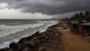
Tropical cyclones are among the most destructive weather systems over warm oceans, bringing strong winds, heavy rain, and storm surges. For public safety, they are tracked through graded warning systems and a formal naming process. In India, the India Meteorological Department (IMD) plays the key role in monitoring North Indian Ocean systems and issuing cyclone advisories.
Tropical Cyclones: Formation and Classification
Tropical cyclones are violent rotating storms that form over tropical or subtropical waters. They have a low-pressure centre, spiralling winds and intense convection. Their formation depends on a set of favourable atmospheric and oceanic conditions.
- Warm sea surface: Ocean waters should generally be above 26.5°C, usually to a depth of at least 50 metres.
- Moist air: High relative humidity is needed in the lower to mid-troposphere.
- Low vertical wind shear: Weak change in wind speed and direction with height helps the system grow vertically.
- Coriolis force: This is required for rotation, so cyclones rarely form very close to the Equator.
- Pre-existing disturbance: A low-level weather disturbance often acts as the seed for cyclone development.
In the North Indian Ocean, the IMD classifies tropical weather systems on the basis of maximum sustained wind speed averaged over three minutes. This classification is important because warnings, preparedness measures and response protocols are linked to storm intensity.
| Classification | Maximum sustained wind speed |
| Low-Pressure Area | Below 31 km/h (17 knots) |
| Depression | 31-49 km/h (17-27 knots) |
| Deep Depression | 50-61 km/h (28-33 knots) |
| Cyclonic Storm | 62-88 km/h (34-47 knots) |
| Severe Cyclonic Storm | 89-117 km/h (48-63 knots) |
| Very Severe Cyclonic Storm | 118-166 km/h (64-89 knots) |
| Extremely Severe Cyclonic Storm | 167-221 km/h (90-119 knots) |
| Super Cyclonic Storm | 222 km/h (120 knots) or more |
IMD Cyclone Warning System and Alert Levels
The IMD, India’s national agency for weather forecasting and cyclone warnings, uses a four-stage warning system to alert authorities and the public. The system is designed to improve preparedness, reduce losses and support disaster management.
- Pre-Cyclone Watch: Issued 72 hours in advance. It gives an early indication of a possible cyclonic disturbance, its intensification and likely impact area. It is issued by the Director General of Meteorology.
- Cyclone Alert: Issued at least 48 hours in advance. It provides the system’s location, intensity, likely movement and the coastal districts that may be affected. Advisories are sent to fishermen, the public and disaster managers.
- Cyclone Warning: Issued at least 24 hours in advance. It contains detailed information on expected landfall, intensity at landfall and associated adverse weather such as rain, wind and storm surge.
- Post-Landfall Outlook: Issued at least 12 hours in advance of expected landfall time. It indicates the likely movement after landfall and the weather expected in interior areas.
Along with these stages, colour-coded alerts help communicate the level of risk in a simple way.
- Green: No adverse weather expected.
- Yellow: Be aware; adverse weather is possible and needs monitoring.
- Orange: Be prepared; significant disruption or danger is possible.
- Red: Take action; very severe weather is expected and immediate response is required.
Exam note: In IMD’s system, Red alert is reserved for very severe weather conditions that require immediate action by authorities and the public.
Cyclone Naming System in the North Indian Ocean
Names make tropical cyclones easier to identify and help avoid confusion in warnings, media reports and emergency communication. In the North Indian Ocean, naming is handled by the WMO and ESCAP Panel on Tropical Cyclones (PTC).
- Governing body: The WMO/ESCAP Panel on Tropical Cyclones assigns names.
- Member countries: Bangladesh, India, Iran, Maldives, Myanmar, Oman, Pakistan, Qatar, Saudi Arabia, Sri Lanka, Thailand, the United Arab Emirates and Yemen.
- Name list: Each of the 13 members contributed names to the list finalised in April 2020, giving a total of 169 names.
- Selection criteria: Names are short, easy to pronounce, familiar to the region and non-offensive.
- When naming begins: A system is named only after it reaches Cyclonic Storm intensity, meaning winds of 62 km/h (34 knots) or more.
- Below that level: Depressions and deep depressions are not named.
- Use of names: Names are used sequentially from the agreed list.
The name Arnab has been designated for the next cyclonic storm in the North Indian Ocean region under this naming system. This helps maintain clarity in advisories and supports risk communication during emergencies.
RSMCs and TCWCs in Tropical Cyclone Monitoring
The World Meteorological Organization coordinates a global tropical cyclone warning programme through Regional Specialized Meteorological Centres (RSMCs) and Tropical Cyclone Warning Centres (TCWCs). These institutions are central to forecasting, warning dissemination and international coordination.
- RSMCs: There are six RSMCs worldwide, each responsible for specific ocean basins.
- IMD as RSMC: The India Meteorological Department, New Delhi, is the RSMC for the North Indian Ocean, covering the Bay of Bengal and the Arabian Sea.
- Functions of RSMCs: They provide track, intensity and landfall forecasts, issue warnings and name tropical cyclones as per agreed procedures.
- TCWCs: These provide more localised or national-level warnings within the areas covered by RSMCs.
Key Prelims Takeaways
- Formation conditions: Tropical cyclones need warm seas, high humidity, low wind shear, Coriolis force and a pre-existing disturbance.
- IMD classification: Cyclones in the North Indian Ocean are classified by 3-minute maximum sustained wind speed.
- Deep Depression: Wind speed is 50-61 km/h (28-33 knots).
- Named systems: A tropical system is named only when it reaches Cyclonic Storm intensity.
- Warning stages: IMD uses Pre-Cyclone Watch, Cyclone Alert, Cyclone Warning and Post-Landfall Outlook.
- Alert colours: Green, Yellow, Orange and Red communicate rising levels of risk and response.
- Regional coordination: The WMO/ESCAP Panel on Tropical Cyclones names systems in the North Indian Ocean, and the IMD is the RSMC for the basin.
Recent Context
A weather system over the Bay of Bengal recently intensified into a deep depression and was monitored by the IMD under its cyclone warning framework. While it did not become a cyclonic storm, the event highlighted how alerts, basin monitoring and naming rules work together in real time. The name Arnab has been reserved for the next cyclonic storm.
| Related | |
|---|---|