Hurricane Lala Hits Hawaii’s Big Island and Maui
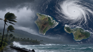
Hurricane Lala strengthened into a Category 1 hurricane on 15 August 2026 with maximum sustained winds of 75 mph while moving just offshore of Hawaii’s Big Island. The storm brought heavy rain, strong winds, power outages, airport closures, flight cancellations, and flood warnings across parts of Hawaii.
Tropical Cyclone Classification
A tropical storm becomes a hurricane when its maximum sustained winds reach at least 74 mph, or 119 km/h, in the Atlantic and eastern Pacific basins. The Saffir-Simpson Hurricane Wind Scale classifies hurricanes from Category 1 to Category 5 based on sustained wind speed.
Hawaii’s Island Geography
The Big Island is the largest island in the Hawaiian archipelago and includes Hilo on the eastern side and Kona on the western side. Maui County includes the island of Maui and several smaller islands, and eastern Maui often receives heavy rainfall during tropical systems.
Weather and Disaster Response Measures
Forecasts on 15 August 2026 projected 10 to 20 inches of rain on the Big Island, with local totals up to 25 inches, and 8 to 12 inches in eastern Maui. The Hawaii Department of Transportation closed Hilo International Airport and Ellison Onizuka Kona International Airport at Keahole at 2:00 p.m. HST, while the Hawaii Department of Water Supply issued an “Essential Needs Only” notice for water use.
Important Facts for Exams
- The National Hurricane Center is the United States agency that issues official tropical cyclone advisories for the Atlantic and eastern Pacific basins.
- The Saffir-Simpson Hurricane Wind Scale uses sustained wind speed and does not measure storm surge or rainfall.
- The Wailuku River flows through Hilo on the Big Island and can rise rapidly during intense rainfall.
- Hilo International Airport and Ellison Onizuka Kona International Airport at Keahole are the two major airports on the Big Island.
Impact on Utilities and Transport
By the afternoon of 15 August 2026, more than 42,000 utility customers had lost power across Hawaii, including over 31,000 on the Big Island and over 7,200 in Maui County. Hawaiian Airlines cancelled numerous neighbour-island flights, and major airlines suspended services between Los Angeles and Hawaii.
Flooding, Landslides and Wind Observations
The U.S. Geological Survey reported that the Wailuku River in Hilo rose from 3.4 feet on Friday night to 16.2 feet by Saturday morning. The Maunakea Weather Center recorded wind gusts above 100 mph, and the Hawaii County Civil Defence Agency reported road closures on the Hawaii Belt Road and Kohala Mountain Road due to landslides and a fallen tree.
Hawaii lies in the central Pacific Ocean and is exposed to tropical cyclones during the Pacific hurricane season. Tropical cyclones in the region can produce flooding, mudslides, coastal inundation, and transport disruption.
| Related | |
|---|---|