Key Global Satellite Navigation Systems and Constellations
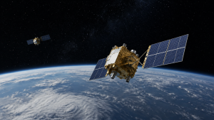
Global Navigation Satellite Systems (GNSS) and Regional Navigation Satellite Systems (RNSS) provide continuous positioning, navigation and timing (PNT) services. These systems are essential for civilian, military and commercial applications, and work by using satellites in different orbital configurations to transmit accurate timing signals.
GNSS Overview
- GNSS vs RNSS: GNSS constellations provide global coverage, usually from Medium Earth Orbit (MEO) at about 19,000 km to 24,000 km. RNSS systems focus on a specific region and often use Geosynchronous Orbit (GSO), Geostationary Orbit (GEO) or Highly Elliptical Orbit (HEO) to keep satellites visible over the target area.
- Core principle: Satellite navigation works on trilateration, where signals from at least four satellites are needed to determine latitude, longitude, altitude and receiver clock bias.
- Atomic clocks: Accuracy depends on highly stable onboard atomic clocks such as rubidium, cesium or hydrogen masers, which measure signal travel time at the nanosecond level.
United States GPS and Russia’s GLONASS
- GPS: The Global Positioning System is operated by the US Space Force. It has 32 operational satellites in MEO at about 20,180 km, arranged in six orbital planes.
- GPS modernization: The next-generation GPS Block IIIF satellites are planned to begin deployment with GPS IIIF SV11 on a Vulcan Centaur rocket in 2028. These satellites will include upgraded search-and-rescue payloads.
- GLONASS: Russia’s Globalnaya Navigatsionnaya Sputnikovaya Sistema has 24 operational satellites in MEO at about 19,130 km across three orbital planes, providing complete global coverage.
- GLONASS upgrades: The newer GLONASS-K series supports L3 code-division multiple access (CDMA) signals, improving interoperability with other navigation systems.
Europe’s Galileo and China’s BeiDou
- Galileo: Europe’s Galileo has 28 operational satellites, 4 unusable satellites and 3 decommissioned satellites out of 34 launched, as of August 2026. It is managed by the European Union Agency for the Space Programme (EUSPA).
- Galileo launches: Its 14th operational launch on December 17, 2025 placed SAT 33 and SAT 34 aboard an Ariane 6 rocket. SAT 34 entered operational service on July 23, 2026.
- Galileo Second Generation: Deployment of 12 G2G satellites is scheduled to begin in 2027, with advanced electric propulsion systems and upgraded inter-satellite links.
- BeiDou: China’s BeiDou Navigation Satellite System (BDS-3) operates 50 active satellites in a hybrid orbit configuration of medium Earth, inclined geosynchronous and geostationary satellites.
- BeiDou modernization: In April 2026, on-orbit upgrades were initiated for BDS-3 satellites. Seven older BeiDou-2 satellites are scheduled for retirement, along with discontinuation of the B2I service.
Regional Systems: India’s NavIC and Japan’s QZSS
- NavIC coverage: India’s Navigation with Indian Constellation (NavIC), built on the Indian Regional Navigation Satellite System (IRNSS) architecture, provides PNT services over the Indian mainland and up to 1,500 km beyond its borders.
- NavIC status: NavIC is currently in a compromised state, with only 3 satellites fully capable of delivering PNT services: IRNSS-1B, IRNSS-1I and NVS-01.
- NavIC expansion: ISRO plans to launch NVS-03, NVS-04 and NVS-05 to restore and expand the core 7-satellite regional coverage.
- QZSS architecture: Japan’s Quasi-Zenith Satellite System (QZSS) is a 6-satellite constellation. Its newest satellite, QZS-7, was launched on August 10, 2026 aboard an H3 rocket.
- QZS-5 failure: QZS-5 was lost on December 22, 2025 because of an H3 rocket second-stage malfunction, delaying achievement of the planned 7-satellite baseline.
- QZSS expansion: Japan’s Cabinet Office plans to expand QZSS from its initial 7-satellite target to 11 satellites to improve redundancy and operational reliability.
- QZS-7 payload: The QZS-7 satellite carries the Situational Awareness Camera Hosted Instrument (SACHI), a US Space Force space domain awareness payload.
| Constellation | Developer | Coverage Type | Orbit Configuration | Active Satellites |
| GPS | United States | Global (GNSS) | MEO (20,180 km) | 32 (as of Sep 2026) |
| GLONASS | Russia | Global (GNSS) | MEO (19,130 km) | 24 (as of Sep 2026) |
| Galileo | European Union | Global (GNSS) | MEO (23,222 km) | 28 (as of Aug 2026) |
| BeiDou | China | Global (GNSS) | Hybrid (MEO/IGSO/GEO) | 50 (as of Sep 2026) |
| NavIC | India | Regional (RNSS) | GEO and GSO | 3 fully functional |
| QZSS | Japan | Regional (RNSS) | HEO and GEO | 6 (as of Aug 2026) |
Key Prelims Takeaways
- Orbital pattern: Global systems such as GPS, GLONASS and Galileo mainly use MEO, while regional systems like NavIC and QZSS use GEO, GSO or HEO for persistent regional visibility.
- Hybrid model: BeiDou combines MEO, IGSO and GEO satellites, making it a hybrid navigation system rather than a pure MEO constellation.
- Trilateration: A minimum of four satellites is required to calculate three-dimensional position and receiver time error.
- Signal evolution: Many systems are shifting from Frequency Division Multiple Access (FDMA) to CDMA for better compatibility and reduced interference.
- NavIC frequency bands: NavIC uses L5 and S-band frequencies, while its second-generation NVS satellites are adding the civilian L1 band.
- Regional relevance: NavIC is important for India’s strategic and civilian PNT needs, while QZSS improves navigation support in Japan and the surrounding Asia-Pacific region.
- Exam focus: Remember the association of each system with its developer, orbit type, and satellite count, as these are common prelims facts.
Current General Studies comprises current-affairs-based, General Studies-rich study material on policies, laws, institutions, economy, science, environment, governance, international relations, and other varied but important topics for UPSC and State PSC Prelims examinations.
Fortnightly PDF compilations: Available here
Originally written on
February 25, 2026
and last modified on
September 5, 2026.
| Related | |
|---|---|