India Identifies 28 Places on Ladakh Official Map
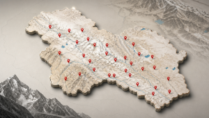
India formally identified 28 places and geographical features on the official Survey of India maps of Ladakh on 2 October 2026. The updated map was prepared in consultation with the Union Territory administration and was made available on the official Survey of India website.
Survey of India and Official Mapping
The Survey of India is the national mapping agency of India and functions under the Department of Science and Technology. It prepares topographical maps, geodetic data, and official cartographic records used by government institutions.
Official maps are used for administrative records, public reference, and standardised naming of geographical features. In India, place names on government maps are part of formal geographic documentation.
Geographical Features Identified in Ladakh
The identified features in Ladakh include peaks, mountains, passes, glaciers, valleys, rivers, lakes, water bodies, and land areas. This list covers both natural and terrain-based features across the Union Territory.
- Named peaks and mountains include Atisha Giri, Kanishka Peak, Karun Pir, Martand Giri, Zorawar Peak, Drak Karpo, Rinchen Zangpo, Sakyasri Giri, Marpa Lotsava Ri, Milarepa Kangri, Shiva Ri, and Maheshvara Ri.
- Passes on the list include Chapchingal Pass and Shachmirk Pass.
- Glaciers identified include Parpik and Skamri, while Shkorga Valley and Yangpa River are also included.
- Guru Rinpoche has been identified as a lake, and Hot Spring has been listed as a water body.
Land Areas and Border Mapping
Several land areas have also been formally identified, including Brangsa, Kuksel, Dehra Compass, Gogra, Kumarayana Point, Panglung, and Shamal Lungpa. These names are now part of the official map record for Ladakh.
The exercise relates to the India-China border region, where place naming has been a recurring issue in cartographic and diplomatic contexts. India has maintained that invented names do not alter territorial status.
Important Facts for Exams
- The Survey of India is India’s national mapping agency.
- Ladakh became a Union Territory on 31 October 2019.
- Official maps are used for administrative and geographic standardisation.
- Place names in disputed border areas often appear in diplomatic and cartographic discussions.
Exam-Relevant Static Facts
Ladakh is a high-altitude region in the western Himalayas and includes major mountain and glacier systems. The region shares borders with China and Pakistan.
| Related | |
|---|---|