India–China Border Disputes and LAC Agreements
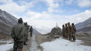
India–China border disputes revolve around the Line of Actual Control (LAC), a disputed and undemarcated boundary that runs through three broad sectors. Because the line is not mutually accepted, both countries rely on bilateral agreements and dialogue mechanisms to prevent escalation.
The dispute has persisted for decades, with flashpoints in Ladakh, Sikkim, and Arunachal Pradesh. For prelims, the key focus areas are the geography of the LAC, major border agreements, and the institutions used to manage tensions.
Geographical Sectors of the Line of Actual Control
- Western Sector: Covers Ladakh and is the most sensitive area, with disputes over Aksai Chin, Depsang Plains, and Demchok.
- Length and scope: India officially places the boundary at 3,488 kilometers, while China claims it to be about 2,000 kilometers.
- Middle Sector: Covers Himachal Pradesh and Uttarakhand and is generally the least disputed segment.
- Eastern Sector: Spans Sikkim and Arunachal Pradesh and broadly follows the McMahon Line, which China disputes.
- Arunachal Pradesh issue: China claims Arunachal Pradesh as South Tibet, making the eastern frontier politically sensitive.
Major Conflict Zones and Strategic Geography
- Aksai Chin: A strategic high-altitude region under Chinese control since the 1950s, located near the junction of Xinjiang and Tibet.
- Depsang Plains: A critical tableland near the Karakoram Pass with strategic access to the Daulat Beg Oldie airstrip.
- Demchok: Lies near the Indus River basin and remains a disputed area in Ladakh.
- Galwan Valley: Became a major flashpoint during the 2020 military standoff.
- Pangong Tso: A trans-boundary lake that also figured prominently in the 2020 tensions.
- McMahon Line: Drawn during the 1914 Simla Accord between Great Britain and Tibet; China does not recognize it.
Key Border Agreements and Protocols
- 1993 Peace and Tranquillity Agreement: Committed both sides to respect the LAC, reduce military tensions, and resolve differences through consultations.
- 1996 Military CBMs Agreement: Prohibited firearms, hazardous chemicals, and blasting operations within a two-kilometer zone of the LAC.
- 2005 Guiding Principles: Laid down political parameters for a boundary settlement and said settled populations in border areas must be considered.
- Working Mechanism for Consultation and Coordination (WMCC): Created in 2012 to handle border affairs through diplomatic consultation.
- 2013 Border Defence Cooperation Agreement (BDCA): Added confidence-building steps such as preventing patrol tailing and setting up hotlines between local military commands.
Diplomatic and Military Dialogue Channels
- Special Representatives (SR) Mechanism: Started in 2003 to find a comprehensive solution to the boundary question.
- Leadership: Co-chaired by India’s National Security Advisor and China’s designated senior representative.
- WMCC: Handles practical and day-to-day border management issues at the diplomatic level.
- Corps Commander Talks: Military-to-military meetings used during face-offs to coordinate disengagement at friction points.
Economic Trade and Hydrological Relations
- Bilateral trade: India–China trade stood at USD 151.1 billion in FY2025–26.
- Trade deficit: India’s deficit with China was about USD 99.21 billion in FY2025–26.
- Hydrological cooperation: An expert-level mechanism shares hydrological data on trans-border rivers, mainly the Brahmaputra and Sutlej, to support flood forecasting.
| Agreement/Mechanism | Core purpose |
| 1993 Peace and Tranquillity Agreement | Respect the LAC and reduce tensions |
| 1996 Military CBMs Agreement | Restrict risky military activities near the LAC |
| 2005 Guiding Principles | Set political parameters for a boundary settlement |
| WMCC | Manage border issues through diplomatic coordination |
| BDCA, 2013 | Prevent escalation through local military confidence-building steps |
Key Prelims Takeaways
- LAC: A disputed, not mutually demarcated, boundary between India and China.
- Three sectors: Western, Middle, and Eastern sectors form the main geographical division of the border.
- Western sector flashpoints: Aksai Chin, Depsang Plains, and Demchok are the most cited problem areas.
- Eastern sector issue: The dispute centers on the McMahon Line and China’s claim over Arunachal Pradesh.
- 1996 CBM significance: Important for restricting armed escalation near the border.
- WMCC and Corps Commander Talks: Key mechanisms for day-to-day management and disengagement.
- Trans-border rivers: Brahmaputra and Sutlej are important in India–China hydrological cooperation.
Current General Studies comprises current-affairs-based, General Studies-rich study material on policies, laws, institutions, economy, science, environment, governance, international relations, and other varied but important topics for UPSC and State PSC Prelims examinations.
Fortnightly PDF compilations: Available here
Originally written on
February 23, 2026
and last modified on
September 5, 2026.
| Related | |
|---|---|