India Assigns Official Names to 27 Places in Arunachal Pradesh
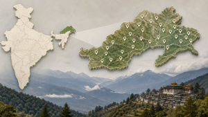
The Ministry of Home Affairs and the Government of Arunachal Pradesh assigned standardised names to 27 places and geographical features on the official maps of the Survey of India on 7 August 2026. The list includes settlements, memorials, lakes, and high-altitude passes in Arunachal Pradesh.
Official Naming and Map Standardisation
Standardised geographical names are used in official cartography, administrative records, and disaster management planning. The Survey of India is the national mapping agency of India and prepares official topographic and thematic maps.
- The updated names were entered on the official Indian map prepared by the Survey of India.
- The Ministry of Home Affairs linked the exercise with removal of administrative ambiguity.
- The naming exercise also covers locations used for public awareness and official reference.
Arunachal Pradesh and Border Geography
Arunachal Pradesh is a north-eastern state of India and shares an international boundary with China, Bhutan, and Myanmar. The Line of Actual Control is the de facto boundary between India and China in several sectors, including parts of Arunachal Pradesh.
- Long Ju is one of the places included in the standardised list.
- Thag La is a high-altitude pass associated with early battles of the 1962 Sino-Indian War.
- Bisa, Dzo La, Riza La, and Pukur La are among the passes named on the updated map.
Memorials, Lakes, and Settlements in the List
The list includes the Sher-e-Thapa Memorial, which honours Trilok Singh Thapa, a war hero of the 1962 conflict. It also includes the Jaswant Garh war memorial, Sambho Sarovar, and settlements such as Jairampur, Maja village, Shivaji Nagar, and Kamlang Nagar.
- Jairampur is a transit hub in Changlang district of Arunachal Pradesh.
- Jaswant Garh is a war memorial in Arunachal Pradesh.
- Sambho Sarovar is a high-altitude lake included in the standardised list.
Important Facts for Exams
- The Survey of India is the oldest scientific department of the Government of India and functions as the national mapping organisation.
- The Line of Actual Control is not a formally demarcated international boundary between India and China.
- The 1962 Sino-Indian War involved fighting in the eastern sector, including areas of present-day Arunachal Pradesh.
- Arunachal Pradesh is often called the “Land of the Rising Sun” in Indian geography.
External Affairs and Sovereignty
The Ministry of External Affairs reaffirmed India’s sovereignty over Arunachal Pradesh on 7 August 2026. India treats Arunachal Pradesh as an integral part of the country in official statements and maps.
| Related | |
|---|---|