Important Concepts in International Maritime Law
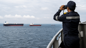
International maritime law sets the rules for navigation, sea boundaries, resource rights, and protection of the marine environment. Its core framework is the United Nations Convention on the Law of the Sea (UNCLOS).
The United Nations Convention on the Law of the Sea (UNCLOS)
- UNCLOS is the main legal framework for maritime activities and is often called the “Constitution of the Oceans.”
- Adopted: 1982 in Montego Bay, Jamaica; entered into force: 1994.
- It replaced the four 1958 Geneva Conventions on the Law of the Sea.
- It balances the sovereign interests of coastal states with the navigational rights of maritime nations.
- Parties: 168 have ratified the convention. The United States has signed but not ratified it, though it treats most provisions as customary international law.
Maritime Zones and Jurisdictions
UNCLOS divides the ocean into distinct zones based on distance from a coastal state’s baseline. The baseline is usually the low-water line along the coast.
| Maritime Zone | Distance from Baseline | Coastal State Jurisdiction | Foreign Vessel Rights |
| Internal Waters | Landward of baseline | Full territorial sovereignty | No general right of passage |
| Territorial Sea | Up to 12 nautical miles (NM) | Full sovereignty over water, air, and seabed | Right of innocent passage |
| Contiguous Zone | Up to 24 NM | Limited law enforcement powers | Freedom of navigation and overflight |
| Exclusive Economic Zone (EEZ) | Up to 200 NM | Sovereign rights over resources | Freedom of navigation, overflight, and cable laying |
| High Seas | Beyond 200 NM | No state has jurisdiction | All high seas freedoms apply |
Internal Waters
- These waters lie landward of the baseline and include bays, ports, rivers, and lakes.
- The coastal state exercises absolute sovereignty here, similar to its authority over land territory.
- Foreign vessels have no automatic right of passage and must seek permission to enter, except in emergencies.
Territorial Sea
- The territorial sea extends up to 12 nautical miles from the baseline. One nautical mile equals 1.852 kilometers.
- The coastal state has full sovereignty over this belt, including the water column, seabed, subsoil, and airspace above.
- Foreign vessels enjoy the right of innocent passage through these waters.
Contiguous Zone
- This zone extends up to 24 nautical miles from the baseline, which is 12 nautical miles beyond the territorial sea.
- The coastal state does not have full sovereignty here.
- It has limited jurisdiction to prevent and punish violations of customs, fiscal, immigration, and sanitary (CFIS) laws.
Exclusive Economic Zone (EEZ)
- The EEZ extends up to 200 nautical miles from the baseline.
- The coastal state has exclusive economic rights to explore, exploit, conserve, and manage natural resources, including fisheries, oil, gas, and energy generation from wind or water.
- Foreign states retain freedom of navigation, overflight, and the right to lay submarine cables and pipelines.
High Seas
- This zone includes all parts of the sea not covered by the EEZ, territorial sea, or internal waters of any state.
- No state may claim sovereignty over any part of the high seas.
- The high seas are reserved for peaceful purposes and are open to all nations, including landlocked states.
Navigation and Passage Rights
International law guarantees specific rights of passage through maritime zones to support global trade and military movement.
Innocent Passage
- This right allows foreign ships to pass through a state’s territorial sea without interference.
- Passage must be continuous and expeditious. Ships may stop or anchor only in cases of distress, force majeure, or to render assistance.
- Passage is innocent as long as it does not prejudice the peace, good order, or security of the coastal state.
- Prohibited activities include military exercises, weapons testing, spying, fishing, smuggling, and deliberate pollution.
- Submarines must travel on the surface and display their national flag.
Transit Passage
- This right applies to straits used for international navigation that connect one part of the high seas or an EEZ to another, such as the Strait of Malacca or the Strait of Gibraltar.
- It cannot be suspended or impeded by coastal states.
- Transit passage allows all ships, including warships, and aircraft to pass through the strait in their normal mode of travel.
- Submarines may transit submerged under this regime, and military aircraft can fly through the airspace above.
Archipelagic Sea Lanes Passage
- An archipelagic state is a nation composed entirely of one or more archipelagos, such as Indonesia or the Philippines.
- To qualify, the ratio of water to land area within the baselines must be between 1:1 and 9:1.
- These states have sovereignty over their archipelagic waters but must designate sea lanes and air routes for foreign vessels.
- Foreign ships and aircraft enjoy passage rights through these routes under rules similar to transit passage.
The Continental Shelf and the Deep Seabed
The seabed contains valuable mineral resources, so clear legal boundaries are needed for exploration and mining.
The Continental Shelf
- The continental shelf comprises the seabed and subsoil of submarine areas extending beyond the territorial sea.
- Every coastal state has a default continental shelf up to 200 nautical miles from its baseline, even if the physical shelf is narrow.
- If the physical continental shelf extends further, a state can claim an extended continental shelf up to a maximum of 350 nautical miles, or 100 nautical miles from the 2,500-meter depth contour.
- Claims for an extended continental shelf must be submitted to the Commission on the Limits of the Continental Shelf (CLCS) for technical approval.
- Coastal states have exclusive sovereign rights to explore and exploit non-living resources, such as petroleum and minerals, and sedentary species, such as clams and crabs, on their continental shelf.
The Area
- “The Area” refers to the seabed, ocean floor, and subsoil beyond the limits of national jurisdiction.
- UNCLOS declares the Area and its resources to be the common heritage of mankind.
- No state or private entity can claim sovereignty or property rights over the Area or its minerals.
- All mining and exploration activities in the Area must be organized and controlled by the International Seabed Authority (ISA).
Specialized International Maritime Bodies
- International Tribunal for the Law of the Sea (ITLOS): Based in Hamburg, Germany, this independent judicial body resolves disputes concerning the interpretation or application of UNCLOS. It has 21 elected judges.
- International Seabed Authority (ISA): Based in Kingston, Jamaica, this organization regulates mineral-related activities in the international seabed area (the Area) and ensures equitable sharing of economic benefits.
- Commission on the Limits of the Continental Shelf (CLCS): This commission has 21 scientific experts. It reviews geological data and makes recommendations to coastal states on claims for an extended continental shelf.
Crucial Legal Doctrines and Enforcement Rights
Maritime law uses special doctrines to balance state sovereignty with the freedom of the seas.
Right of Hot Pursuit
- This doctrine allows a coastal state to pursue and arrest foreign vessels that have violated its laws.
- The pursuit must begin while the foreign ship or its boats are inside the internal waters, territorial sea, or contiguous zone of the pursuing state.
- The pursuit must be continuous and uninterrupted.
- The right ends as soon as the vessel enters the territorial sea of its own country or a third state.
Right of Visit
- On the high seas, a warship of any nation can board a foreign merchant ship if there are reasonable grounds to suspect illegal activity.
- Authorized reasons include suspicion of piracy, slave trade, unauthorized broadcasting, or sailing without nationality.
Flags of Convenience
- Every vessel must be registered in a specific country, known as its flag state, and must fly that country’s flag.
- UNCLOS requires a genuine link between the ship and the flag state.
- Many shipowners register vessels in open-registry countries like Panama, Liberia, or the Marshall Islands. This is called using flags of convenience.
- It allows owners to benefit from lower taxes, cheaper registration fees, and less stringent labor and environmental regulations.
Key Environmental and Safety Treaties
Complementary treaties developed by the International Maritime Organization (IMO) work alongside UNCLOS to regulate maritime activities.
- SOLAS (International Convention for the Safety of Life at Sea): Established in 1914 after the Titanic sinking, it mandates safety standards for ship construction, equipment, and operations.
- MARPOL (International Convention for the Prevention of Pollution from Ships): The primary treaty regulating ocean pollution from ships. It covers oil spills, chemical discharge, sewage, garbage, and air emissions.
- COLREGs (Convention on the International Regulations for Preventing Collisions at Sea): Establishes navigation rules, light displays, and sound signals to prevent collisions between vessels.
- The BBNJ Agreement (High Seas Treaty): Adopted under UNCLOS, this treaty establishes a legal framework for conservation and sustainable use of marine biological diversity in areas beyond national jurisdiction.
Recent Context
In August 2026, Iran and Oman agreed on a shipping route map for traffic through the Strait of Hormuz. The arrangement was framed as an independent measure to protect commercial shipping while preserving sovereignty, amid wider concerns over freedom of navigation and coastal jurisdiction.
Rare Facts for Prelims
- One nautical mile is exactly 1.852 kilometers.
- UNCLOS Part XI governs the deep seabed regime known as The Area.
- ITLOS can hear disputes even through special chambers for certain categories of cases.
- Innocent passage applies only in the territorial sea, not in internal waters.
- Transit passage is broader than innocent passage and cannot be suspended by the coastal state.
- Archipelagic sea lanes passage is specifically designed for archipelagic states with designated routes for international navigation.
| Related | |
|---|---|