What do you understand by ‘Standard Positioning Systems’ and ‘Precision Positioning Systems’ in the GPS era? Discuss the advantages India perceives from its ambitious IRNSS programme employing just seven satellites. (UPSC 2015)
Standard Positioning System in the GPS era is the open, civilian service available to all users. It gives free access and basic location accuracy, generally enough for phones, vehicles and navigation apps. Precision Positioning System is a restricted, encrypted service for defence and authorised agencies, offering far better accuracy, resistance to jamming and higher reliability.
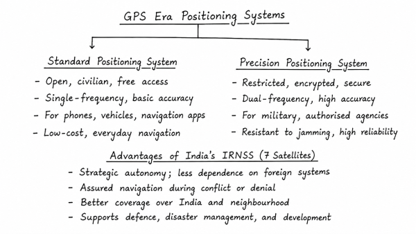
- SPS: open, single-frequency, low-cost, suitable for everyday navigation.
- PPS: secured, dual-frequency, high-accuracy, used for military and sensitive applications.
Why IRNSS/NAVIC matters:
- It gives India strategic autonomy, reducing dependence on foreign systems during conflict or denial of access.
- A regional constellation needs only seven satellites, making it cheaper and quicker than a global system.
- It provides reliable coverage over India and about 1,500 km around it, ideal for transport, fisheries, disaster relief and timing services.
- Its dual-frequency signals improve accuracy in tropical and urban conditions.
Thus, IRNSS is a cost-effective, sovereign and mission-oriented navigation system tailored to India’s security and development needs.
Originally written on
August 30, 2026
and last modified on
August 30, 2026.