The frequency of urban floods due to high intensity rainfall is increasing over the years. Discussing the reasons for urban floods, highlight the mechanisms for preparedness to reduce the risk during such events. (UPSC 2016)
Urban floods are becoming more frequent because intense rain now falls in shorter bursts, while cities continue to expand over natural drains, wetlands and floodplains. When impervious surfaces increase and drainage capacity remains outdated, runoff rises sharply and waterlogging turns into flooding.
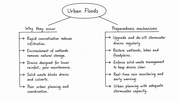
- Why urban floods occur
- Rapid concretisation reduces infiltration and overloads stormwater drains.
- Encroachment of wetlands, lakes and marshes removes natural storage spaces.
- Drains are often designed for lower rainfall intensities and are poorly maintained.
- Solid waste blocks drains and culverts during heavy rain.
- Poor coordination between urban local bodies, development authorities and utilities delays action.
- Preparedness mechanisms
- Prepare micro-level flood risk maps using GIS, contour mapping and drainage audits.
- Upgrade stormwater drains, pump stations and retention basins for higher rainfall events.
- Protect and restore wetlands, lakes, floodplains and other blue-green buffers.
- Issue real-time early warnings through rain gauges, radar, mobile alerts and control rooms.
- Ensure desilting, solid waste removal and pre-monsoon inspections before each season.
- Set up city disaster plans, evacuation routes, shelters and mock drills for vulnerable wards.
Thus, urban flood risk can be reduced only by combining resilient infrastructure, ecological restoration, better land-use planning and strong last-mile preparedness. A city that plans for water, rather than only against it, will cope far better with extreme rainfall.
Originally written on
August 31, 2026
and last modified on
August 31, 2026.