Disaster preparedness is the first step in any disaster management process. Explain how hazard zonation mapping will help disaster mitigation in the case of landslides. (UPSC 2019)
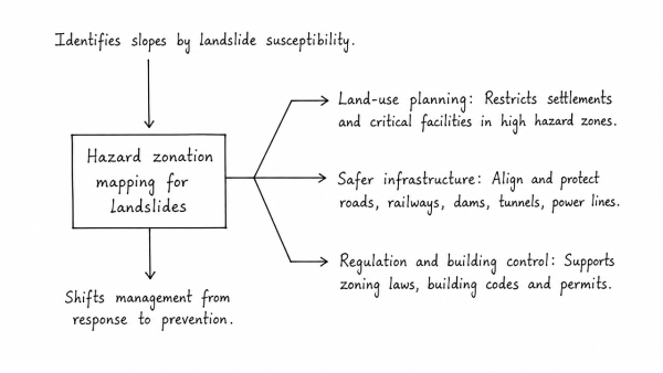
Disaster preparedness starts with identifying where landslides are most likely. Hazard zonation mapping classifies slopes by susceptibility and helps shift disaster management from response to prevention.
Uses in landslide mitigation
- Land-use planning: It demarcates very low to very high hazard zones, enabling relocation or restriction of settlements, schools, hospitals and other critical facilities from unstable slopes.
- Safer infrastructure: Roads, railways, dams, tunnels and power lines can be aligned along safer corridors, or protected with retaining walls, slope drainage, rock bolts and buttresses.
- Regulation and building control: It supports zoning laws, building codes and checks on slope cutting, deforestation and unscientific cultivation on steep terrain.
- Early warning and evacuation: Combined with rainfall, seismic and ground-motion data, it helps identify vulnerable areas for timely alerts, evacuation routes and safe shelters.
- Targeted treatment: Authorities can prioritise afforestation, terracing, check dams and surface/sub-surface drainage where they will reduce soil saturation and slope failure most effectively.
Thus, hazard zonation mapping reduces exposure, guides safer development and improves preparedness, making landslide mitigation more scientific, localised and cost-effective.
Originally written on
September 1, 2026
and last modified on
September 1, 2026.