Africa was chopped into states artificially created by the accident of European competition. Analyse. (UPSC 2013)
Africa’s political map is largely a colonial construct. The Berlin Conference (1884–85) and later scramble for Africa divided the continent with little regard for ethnic, linguistic or historical realities, making many borders arbitrary and contested.
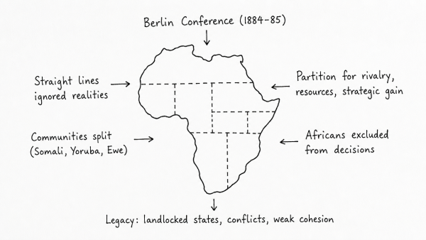
- Artificial borders: Straight lines and poorly mapped boundaries split communities such as the Somali, Yoruba and Ewe, while rival groups were forced into one state, as in Nigeria and Rwanda-Burundi.
- European competition: Partition aimed at rivalry, resource control and strategic gain, not African stability; Africans were excluded from decision-making.
- Legacy: These borders produced landlocked states, weak transport links, fragmented markets and porous frontiers that encourage insurgency, smuggling and cross-border conflict.
Yet, after independence, the OAU’s 1964 decision to respect inherited boundaries gave them legal acceptance, so the challenge now is managing this colonial legacy through integration, cooperation and peaceful dispute settlement.
Originally written on
August 28, 2026
and last modified on
September 6, 2026.