Madhya Pradesh Launches GIS Road-Planning and Project-Monitoring Systems
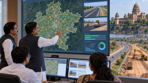
On 12 February 2026, Madhya Pradesh Chief Minister Dr. Mohan Yadav inaugurated Project Management System 2.0 and a GIS-based Road Network Master Plan at a Public Works Department capacity-building workshop at Ravindra Bhavan in Bhopal. The systems are intended to improve transparency, efficiency and oversight in public-works planning and monitoring.
Project monitoring system
Project Management System 2.0 is designed to track road projects through planning, implementation and inspection, and monitor their overall progress. Public Works Minister Rakesh Singh said it would provide information on project status, approvals, current conditions and estimated completion times.
GIS-based road planning
Developed by engineers from the Bhaskaracharya Institute, the Road Network Master Plan is intended to support planning based on road quality and GIS-based budget planning. It will identify roads district-wise and village-wise, assess existing conditions and upgrade needs, and map road requirements linked to tourism, industry, national and state highways, and markets. No completed mapping or project outcomes had been quantified by the reporting date.
Important Facts for Exams
- Location as data key: GIS uses spatial location as a key index, allowing information that was previously unrelated to be linked and analysed together.
- Geometry and attributes: A GIS database holds representations of geographic features, including both their geometry—their location and shape—and their associated properties or attributes.
| Related | |
|---|---|