India Objects to UN Map Showing Arunachal, Aksai Chin
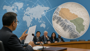
India raised objections on 9 September 2026 to a new United Nations world map that showed anomalies in the depiction of Arunachal Pradesh and Aksai Chin. The map was issued by the United Nations Geospatial unit on 1 July 2026 and used the Equal Earth projection, an equal-area cartographic projection designed to represent landmasses with comparable area proportions.
UN Geospatial Map and Cartographic Projection
The Equal Earth projection is a pseudocylindrical equal-area map projection introduced in 2018 for world mapping. The United Nations Geospatial map showed Arunachal Pradesh and Aksai Chin as separate regions between Indian and Chinese boundary claims, which relates to the unresolved India-China boundary dispute.
India’s Position on Territorial Depiction
The Ministry of External Affairs stated on 8 September 2026 that Arunachal Pradesh is an integral part of India and that Aksai Chin is part of the Union Territory of Ladakh. India also stated that its sovereign territory, including Jammu and Kashmir and Ladakh, must be shown in line with India’s official map.
UN General Assembly Resolution on Map Representation
India voted in favour of the United Nations General Assembly resolution titled “Correct the Map” on 4 September 2026. India clarified on 6 September 2026 that the vote supported the principle of equal-area maps and did not amount to endorsement of any specific map, projection, or boundary depiction.
Important Facts for Exams
- Arunachal Pradesh is a state in north-eastern India and is claimed by China as part of South Tibet.
- Aksai Chin is a high-altitude plateau in the western sector of the India-China boundary dispute.
- The Equal Earth projection is an equal-area world map projection used in cartography.
- The Ministry of External Affairs is India’s nodal ministry for foreign relations and diplomatic communication.
Boundary Dispute and Official Mapping
The India-China boundary dispute has three main sectors: western, middle, and eastern. India’s official position requires the depiction of Jammu and Kashmir, Ladakh, Arunachal Pradesh, and Aksai Chin in accordance with its constitutional and administrative map.
| Related | |
|---|---|