Karnataka Cabinet Approves AgriTech Mission and IIIT Raichur AI Centre
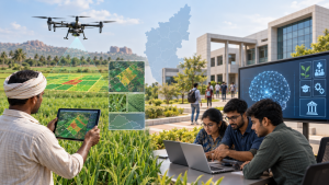
On 19 July 2026, the Karnataka Cabinet approved the Karnataka AgriTech Mission-2026, a three-year initiative estimated to cost ₹35.99 crore, and granted administrative approval for an AI Centre of Excellence at IIIT Raichur.
Karnataka AgriTech Mission-2026
The mission aims to strengthen agricultural advisory services, crop monitoring and crop identification through remote sensing, drone technology, artificial intelligence and geospatial analytics. It proposes an integrated digital crop survey combining satellite imagery, drone surveys, geographic information system (GIS), AI and machine learning with field verification to improve data accuracy and reliability.
AI Centre at IIIT Raichur
The centre is estimated to cost ₹12 crore over five years and is intended to serve as a regional technology hub for North Karnataka’s 13 districts. Its planned work includes AI education, research, innovation and entrepreneurship, alongside AI-based solutions for agriculture, healthcare, education, micro, small and medium enterprises (MSMEs), and governance.
Important Facts for Exams
- Spatial data linkage: A geographic information system (GIS) uses location as a common index to link information that would otherwise remain unrelated.
- Raster and vector data: GIS commonly stores spatial information as raster images or vector data; vectors represent mapped features as points, lines and polygons.
- Temporal resolution: For remote sensing, temporal resolution is the frequency of satellite or aircraft flyovers, relevant when observations must track change over time.
| Related | |
|---|---|