Indonesia Issues Tsunami Warning After Flores Quake
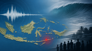
A 7.7-magnitude earthquake struck off Flores Island, Indonesia, on 15 August 2026 at 5:58 AM local time. The United States Geological Survey placed the shallow quake at a depth of 10 kilometres and located its epicentre about 68 kilometres north-northwest of Ende.
Earthquake Measurement and Epicentre
Earthquakes are measured on magnitude scales that estimate the energy released at the source. The United States Geological Survey reported the Flores event as a shallow earthquake, and shallow quakes occur at depths of less than 70 kilometres.
The epicentre is the point on the Earth’s surface directly above the focus of an earthquake. In this case, the epicentre lay offshore near Flores Island in the Lesser Sunda Islands region of eastern Indonesia.
Tsunami Warning and Monitoring Agencies
Indonesia’s Meteorology, Climatology, and Geophysics Agency issued a tsunami warning for East Nusa Tenggara, South Sulawesi, and West Nusa Tenggara. The agency advised residents to stay away from coastlines until the warning was lifted.
The agency later lifted the warning after tide gauges recorded wave changes of less than one metre. Tide gauges are instruments used to measure sea-level variation and tsunami-related changes along coasts.
Damage, Casualties, and Aftershocks
The Indonesian National Disaster Management Agency confirmed at least two deaths at L Say Maumere port and several injuries. Structural damage was reported across Flores Island, including the collapse of a waiting room at the Pelni port terminal in Maumere and roof damage at St. Peter Major Seminary in Sikka.
Medical workers at several hospitals evacuated patients, beds, and equipment outdoors to create temporary treatment areas. The United States Geological Survey also recorded multiple aftershocks, with the largest measuring magnitude 6.1.
Important Facts for Exams
- The United States Geological Survey is the United States federal agency that monitors earthquakes, volcanoes, and other natural hazards.
- BMKG stands for Meteorology, Climatology, and Geophysics Agency, which is Indonesia’s national agency for weather and seismic monitoring.
- Indonesia lies on the Pacific Ring of Fire, a zone known for frequent earthquakes and volcanic activity.
- Tsunami warnings are issued when undersea earthquakes can displace large volumes of water and generate coastal waves.
Indonesia’s Seismic Risk
Indonesia is one of the world’s most earthquake-prone countries because it lies near the boundaries of the Indo-Australian, Eurasian, and Pacific tectonic plates. Flores Island is part of East Nusa Tenggara, a province in eastern Indonesia that has experienced repeated seismic activity.
| Related | |
|---|---|