Hello Guest !
Register or Login
₹
0.00
Home
Current Affairs
Current Affairs Quiz
General Knowledge (GK) Questions
E-Books
Printed Books
Hindi
Current Affairs
Daily MCQs
📝 Daily Current Affairs Quiz
📝 Daily Current Affairs Quiz [UPSC]
Monthly MCQs
Current Affairs Quiz – July 2025
Current Affairs Quiz – June 2025
Current Affairs Quiz – May 2025
Current Affairs Quiz – April 2025
Current Affairs Quiz – March 2025
Current Affairs Quiz – February 2025
📁 Previous Months Quiz - 2017 - 2024
Topic Wise CA MCQs
🌍 India Current Affairs MCQs
🏛 Government Schemes MCQs
💼 Business, Economy & Banking MCQs
🚀 Defence MCQs
📈 Reports and Indices MCQs
🌿 Environment & Biodiversity MCQs
🏆 Awards, Honours & Persons MCQs
📍 Places in News MCQs
🎉 Important Days and Events MCQs
🏀 Sports Current Affairs MCQs
🔬 Science & Technology MCQs
🎤 Summits and Conferences in MCQs
🌐 International MCQs
🖼 Art & Culture MCQs
Current Affairs Articles
🗞 Current Affairs Today
📋 Current Affairs - May, 2025
📋 Current Affairs - April, 2025
📁 Previous Months Articles
CA MCQs in Other Languages
📝 हिन्दी करेंट अफेयर्स
📝 ಪ್ರಚಲಿತ ವಿದ್ಯಮಾನಗಳು
📝 मराठी चालू घडामोडी
GK MCQs Section
SSC/RRB/States Level MCQs
📜 Ancient Indian History
🗡️ Medieval Indian History
🏛️ Modern Indian History
🗺️ Indian Geography
🌏 World Geography
⚖️ Indian Polity & Constitution
🐾 Environment & Biodiversity
🕉️ Indian Art & Culture
🏆 Sports GK
💰 Indian Economy
🔬 General Science
🧬 General Science - Biology
💡 General Science - Physics
🧪 General Science - Chemistry
🗿 World History
✍️ Books & Authors
🔍 All GK Questions Categories
Home
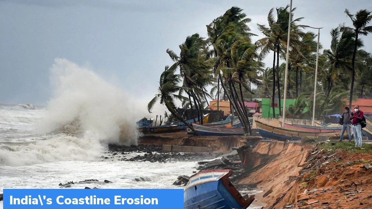
indias-coastline-erosion
indias-coastline-erosion
April 12, 2022
Leave a Reply
Cancel reply
Your email address will not be published.
Required fields are marked
*
Comment
*
Name
*
Email
*
Δ
🔍
Archives
July 2025
(39)
June 2025
(337)
May 2025
(387)
April 2025
(383)
E-Books
Current Affairs Monthly 240 MCQs
CA Articles+MCQs [Fortnightly PDF]
CA Articles [Monthly Datewise PDF]
CA Articles [Monthly Topic Wise PDF]
CA Articles [Yearly PDF]
States PSC General Studies
🌾 Andhra Pradesh General Studies (APPSC)
🦜 Arunachal Pradesh General Studies (APPSC)
🛶 Assam General Studies (APSC)
🧱 Bihar General Studies (BPSC)
🌋 Chhattisgarh General Studies (CGPSC)
🌊 Goa General Studies (GPSC)
🧵 Gujarat General Studies (GPSC)
🛤️ Haryana General Studies (HPSC)
🏞️ Himachal Pradesh General Studies (HPPSC)
❄️ Jammu & Kashmir General Studies (JKPSC)
⚒️ Jharkhand General Studies (JPSC)
🪕 Karnataka General Studies (KPSC)
🌴 Kerala General Studies (KPSC)
🌧️ Meghalaya General Studies (MPSC)
🏹 Madhya Pradesh General Studies (MPPSC)
🚋 Maharashtra General Studies (MPSC)
🥁 Manipur General Studies (MPSC)
🧣 Mizoram General Studies (MPSC)
🪓 Nagaland General Studies (NPSC)
🐘 Odisha General Studies (OPSC)
🪙 Punjab General Studies (PPSC)
🏜️ Rajasthan General Studies (RPSC)
🧭 Sikkim General Studies (SPSC)
🎭 Tamil Nadu General Studies (TNPSC)
📜 Telangana General Studies (TSPSC)
🌳 Tripura General Studies (TPSC)
🏯 Uttar Pradesh General Studies (UPPSC)
⛰️ Uttarakhand General Studies (UKPSC)
🎨 West Bengal General Studies (WBPSC)
Latest in Hindi
हरियाणा में ‘बेटी बचाओ-बेटी पढ़ाओ’ अभियान का नया चरण: लिंगानुपात सुधार की ओर मजबूत कदम
भारतीय वैज्ञानिकों की ऊर्जा भंडारण में क्रांति: सुपरकैपेसिटर के लिए नई सामग्री का विकास
जम्मू-कश्मीर में मत्स्य और डेयरी क्षेत्र का कायाकल्प: पीएमएमएसवाई और ब्लू रिवोल्यूशन की सफलता
अंतरिक्ष में भारत की सांस्कृतिक छाप: Gaganyaan मिशन से पहले Ax-04 से मिलेंगे महत्वपूर्ण अनुभव
वन स्वीकृति प्रक्रिया में सुधार: पर्यावरण मंत्रालय की नई दिशा और FAC की सिफारिशें