Administrative Divisions of Bihar: Divisions, Districts and Headquarters
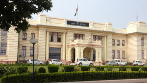
Bihar has a well-defined administrative setup built for governance, revenue collection, development work, and law and order. The state is organized into divisions, districts, subdivisions, blocks, gram panchayats, and villages.
For Prelims revision, the most useful facts are the number of divisions and districts, the divisional headquarters, district headquarters, and a few border and size-based distinctions.
Administrative Structure of Bihar
- Divisions (Pramandal): Bihar has 9 administrative divisions, each headed by a Divisional Commissioner, usually a senior IAS officer.
- Districts (Zila): The state has 38 districts, headed by a District Magistrate or Deputy Commissioner.
- Subdivisions (Anumandal): Bihar has 101 subdivisions, administered by SDMs or SDOs.
- Community Development Blocks (Prakhand): There are 534 CD blocks, which handle grassroots development and welfare implementation through BDOs.
- Local units: Bihar also has 8,406 Gram Panchayats and 45,103 villages as primary rural governance units.
Divisions of Bihar and Their Districts
| Division | Headquarters | Districts |
| Patna | Patna | Patna, Nalanda, Bhojpur, Rohtas, Buxar, Kaimur |
| Tirhut | Muzaffarpur | Muzaffarpur, West Champaran, East Champaran, Vaishali, Sitamarhi, Sheohar |
| Saran | Chapra | Saran, Siwan, Gopalganj |
| Darbhanga | Darbhanga | Darbhanga, Madhubani, Samastipur |
| Kosi | Saharsa | Saharsa, Madhepura, Supaul |
| Purnia | Purnia | Purnia, Katihar, Araria, Kishanganj |
| Bhagalpur | Bhagalpur | Bhagalpur, Banka |
| Munger | Munger | Munger, Jamui, Khagaria, Lakhisarai, Begusarai, Sheikhpura |
| Magadh | Gaya | Gaya, Nawada, Aurangabad, Jehanabad, Arwal |
Important Features of Major Divisions
- Patna Division: Covers six districts in southwest and central Bihar south of the Ganges. Patna is the state capital and the seat of the Bihar State Legislature, Patna High Court, and the state secretariat.
- Nalanda: Its headquarters is Bihar Sharif.
- Bhojpur: Its headquarters is Arrah.
- Rohtas: Its headquarters is Sasaram.
- Kaimur: Its headquarters is Bhabua.
- Tirhut Division: Located north of the Ganges and includes six north-western districts. West Champaran is the largest district in Bihar by area, while Sheohar is among the smallest districts in the state.
- West Champaran: Headquarters is Bettiah; area is 5,228 sq km.
- East Champaran: Headquarters is Motihari.
- Vaishali: Headquarters is Hajipur.
- Saran Division: Formed from the historic Saran Commissionership and includes Saran, Siwan, and Gopalganj. Saran district headquarters is Chapra.
- Darbhanga Division: Lies in the Mithila cultural belt and includes Darbhanga, Madhubani, and Samastipur.
- Madhubani: Borders Nepal to the north and is known as the centre of traditional Mithila folk paintings.
- Kosi Division: Includes Saharsa, Madhepura, and Supaul, and is strongly shaped by the floodplains of the Kosi river system.
- Supaul: Borders Nepal to the north.
- Purnia Division: Covers Purnia, Katihar, Araria, and Kishanganj. Kishanganj is the easternmost district of Bihar and borders West Bengal and Nepal.
- Katihar: A major railway transit junction connecting northeast India.
- Bhagalpur Division: The smallest division by district count, with only 2 districts: Bhagalpur and Banka.
- Bhagalpur: Lies on the south bank of the Ganges and is a regional hub for the silk textile industry.
- Banka: Forms the southern boundary bordering Jharkhand.
- Munger Division: Spans both sides of the Ganges and includes Munger, Begusarai, Khagaria, Lakhisarai, Jamui, and Sheikhpura.
- Begusarai: An important industrial and petrochemical centre with the Barauni Refinery and Thermal Power Station.
- Sheikhpura: Among the least populated districts in Bihar.
- Magadh Division: Includes Gaya, Nawada, Aurangabad, Jehanabad, and Arwal.
- Gaya: Headquarters of the division and the second-largest district in Bihar by area, at 4,976 sq km.
- Arwal: Carved out of Jehanabad in 2001 and is the newest and smallest district in the Magadh division.
Border Districts and Administrative Facts
- Nepal border: West Champaran, East Champaran, Sitamarhi, Madhubani, Supaul, Araria, and Kishanganj.
- West Bengal border: Kishanganj, Purnia, and Katihar.
- Uttar Pradesh border: West Champaran, Gopalganj, Siwan, Saran, Bhojpur, Buxar, Kaimur, and Rohtas.
- Jharkhand border: Rohtas, Aurangabad, Gaya, Nawada, Jamui, Banka, Bhagalpur, and Katihar.
- District headquarters differing from district names: Bhojpur-Arrah, Kaimur-Bhabua, Nalanda-Bihar Sharif, Rohtas-Sasaram, Saran-Chapra, East Champaran-Motihari, and West Champaran-Bettiah.
Key Prelims Takeaways
- State structure: Bihar has 9 divisions, 38 districts, 101 subdivisions, and 534 CD blocks.
- Largest district by area: West Champaran with 5,228 sq km.
- Second-largest district by area: Gaya with 4,976 sq km.
- Smallest district: Sheohar.
- Most populous district: Patna.
- Least populous district: Sheikhpura.
- Fewest districts in a division: Bhagalpur Division has only 2 districts.
Current General Studies comprises current-affairs-based, General Studies-rich study material on policies, laws, institutions, economy, science, environment, governance, international relations, and other varied but important topics for UPSC and State PSC Prelims examinations.
Fortnightly PDF compilations: Available here
Originally written on
June 21, 2026
and last modified on
September 6, 2026.
| Related | |
|---|---|