Applications of Remote Sensing in Governance
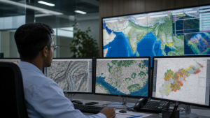
Remote sensing strengthens governance by giving administrators timely, accurate and wide-area spatial data for planning, monitoring and public service delivery. It supports data-driven decisions in agriculture, forests, disasters, urban growth, rural works, water management and coastal regulation.
Concept of Remote Sensing in Governance
Remote sensing gathers data about the Earth’s surface from a distance. It uses sensors mounted on satellites or aircraft to record reflected or emitted radiation. Every physical feature, such as vegetation, soil and water, has a unique spectral signature. Sensors detect these variations to map landscapes.
In public administration, spatial data helps in evidence-based planning. The National Geospatial Policy guides the use of this data. Traditional field surveys are often slow, costly and difficult to conduct in remote areas. Space-based remote sensing provides wide-area coverage at a lower cost. This technology allows administrators to plan, execute and monitor public schemes with high accuracy.
Agriculture and Crop Resource Administration
Agricultural governance uses spatial data to monitor food security and manage systemic risks.
- Crop Yield Forecasting: The Ministry of Agriculture runs the FASAL program. It uses optical and microwave data to estimate crop acreage. This program forecasts yields before harvest to help with trade decisions.
- Horticultural Assessment: The CHAMAN project maps major horticultural crops like fruits and vegetables. It helps in planning cold chain infrastructure and expanding crop areas.
- Drought Assessment: The National Agricultural Drought Assessment and Monitoring System (NADAMS) tracks crop health. It uses satellite-derived vegetation indices to warn state authorities about drought conditions.
- Crop Insurance: The Pradhan Mantri Fasal Bima Yojana (PMFBY) utilizes satellite data to verify crop damage. This process reduces delays in insurance payouts and minimizes dispute cases.
Forest Cover and Biodiversity Conservation
Remote sensing helps in monitoring national forest wealth and meeting global climate goals.
- Forest Mapping: The Forest Survey of India (FSI) utilizes satellite imagery from the Resourcesat series. This data compiles the biennial India State of Forest Report (ISFR). The report tracks changes in forest cover and density across the country.
- Forest Fire Monitoring: FSI uses MODIS and SNPP-VIIRS sensor data to identify active forest fires. It sends daily SMS alerts with coordinates to state forest departments to contain fires.
- Biomass Estimation: Satellite-derived indices help estimate forest biomass and soil carbon. This data helps India report to international climate platforms like the UNFCCC.
- Wildlife Conservation: Spatial data tracks wildlife corridors and maps forest fragmentation. This tracking helps manage protected habitats and control invasive species.
Disaster Management and Emergency Response
Disaster managers use satellite data to save lives and plan relief activities.
- Flood Mapping: Active radar satellites like RISAT penetrate thick clouds during monsoon seasons. They map flooded zones in real-time. The National Remote Sensing Centre (NRSC) uploads these maps to the Bhuvan portal to guide rescue forces.
- Cyclone Prediction: INSAT-3D/3DR and Scatsat-1 monitor atmospheric structures and ocean winds. This monitoring helps the India Meteorological Department (IMD) track storm paths and issue evacuation alerts.
- Landslide Zonation: High-resolution digital elevation models (DEMs) identify landslide-prone areas along mountain highways. This identification assists in preventive planning.
- Glacial Lake Monitoring: Satellites track the expansion of glacial lakes in the Himalayas to warn authorities about potential Glacial Lake Outburst Floods (GLOFs).
Urban Infrastructure and Smart City Planning
Urban planning departments apply remote sensing to guide urban growth and build utilities.
- Master Plans: Under the National Urban Information System (NUIS), planners create base maps at a 1:10,000 scale. These maps help in zoning and tracking unauthorized construction.
- Smart Cities: Satellite data maps urban heat islands, tracks land-use changes and monitors infrastructure development.
- Water Rejuvenation: The Bhuvan Urban Water Information System (UWIS) maps urban lakes under the AMRUT scheme. It helps municipal bodies monitor temporal water spread.
- Highway Corridor Alignment: The National Highways Authority of India (NHAI) uses Cartosat data to plan new road corridors. It monitors construction progress and verifies land acquisition limits.
Rural Development and Welfare Asset Geotagging
Space-based inputs bring transparency and accountability to rural development projects.
- Geo-MGNREGA: More than 6 crore rural assets, including community ponds and rural roads, are geotagged. This process ensures that physical assets exist on the ground and prevents double-billing.
- Yuktdhara Planning Portal: Gram Panchayats use this portal to plan land and water conservation works.
- Integrated Watershed Management: Satellites monitor watershed projects under the Pradhan Mantri Krishi Sinchayee Yojana (PMKSY). This monitoring tracks changes in vegetation and soil health over multiple years.
- Housing Verification: Mobile applications linked to Bhuvan geotag the progress of houses under the PM Awas Yojana (Gramin). Funds are released only after confirming the construction stages.
Water Resource Management and Ocean Governance
Spatial data ensures the scientific management of inland water and marine resources.
- Groundwater Mapping: Under the National Rural Drinking Water Programme (NRDWP), NRSC generates nationwide maps. These maps identify promising aquifers to help engineers select drilling sites in rural areas.
- Bhuvan Ganga Portal: This portal tracks point sources of pollution along the Ganga river basin to support clean-up actions.
- Potential Fishing Zone (PFZ) Advisories: Oceansat-3 compiles sea surface temperature data. This data generates coordinates of productive fishing zones, which are broadcast to fishermen to save fuel and travel time.
- Coastal Zone Regulation: Satellites monitor shoreline changes, mangrove loss and coral bleaching. This monitoring ensures adherence to coastal protection rules.
Key Space Technologies and Portals in Governance
| Satellite Series / Portal | Technical Specialization | Governance Utility |
| Cartosat Series | High-resolution panchromatic and multispectral imaging | Cadastral mapping, urban zoning, highway alignment, infrastructure monitoring |
| Resourcesat Series | Medium-to-high resolution multispectral sensors | Crop area estimation, forest density mapping, wasteland tracking |
| RISAT Series | Active Synthetic Aperture Radar (SAR) | Cloud-penetrant imaging, flood inundation mapping, border security |
| Oceansat Series | Ocean color monitors and scatterometers | Marine fishery advisories, ocean wind tracking, coastal zone regulation |
| INSAT Series (3D/3DR) | Meteorological atmospheric sounders and imagers | Weather forecasting, storm alerts, disaster risk reduction |
| Bhuvan Geoportal | Indigenous GIS and Earth observation platform | Geotagging rural assets, planning watershed projects, urban water monitoring |
| Yuktdhara Portal | Geospatial planning tool | Decentralized planning for Gram Panchayats |
| MOSDAC & VEDAS | Spatial data archiving and computing platforms | Weather monitoring, climate studies, agricultural research |
Remote sensing has become a key governance tool because it supports public service delivery, environmental governance and data-driven planning with faster and wider coverage than field surveys.
Recent Context
Earth observation satellites are used for weather monitoring, agricultural assessment, disaster management and security-related observation. EOS-05 (GISAT-1A) is planned as India’s first imaging satellite to operate from a geosynchronous orbit.
Rare Facts for Prelims
- Geostationary orbit: It lies about 35,786 km above the equator and has an orbital period equal to Earth’s rotation period.
- FASAL expansion: FASAL stands for Forecasting Agricultural output using Space, Agro-meteorology and Land-based observations.
- MODIS use in fire alerts: MODIS is widely used globally for near-real-time hotspot detection because it offers frequent revisits.
- RISAT advantage: Radar satellites can capture images even at night and through clouds, making them useful during monsoons.
- PFZ relevance: Potential Fishing Zone advisories combine ocean colour and sea surface temperature patterns to locate likely fish aggregations.
- ISFR frequency: The India State of Forest Report is published every two years by the Forest Survey of India.
| Related | |
|---|---|