Uttar Pradesh completes Ganga floodplain demarcation
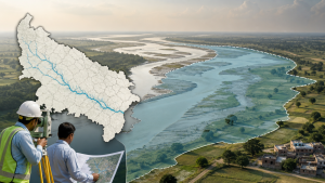
Uttar Pradesh completed the physical demarcation of the 700-kilometre Ganga River floodplain zone across 13 districts from Unnao to Ballia. The boundary work was marked on the ground with 7,350 pillars, and the status was placed before the National Green Tribunal in August 2026.
Ganga floodplain zone
The floodplain zone of a river is the low-lying area adjacent to the river channel that can receive floodwater during high-flow periods. In the case of the Ganga in Uttar Pradesh, the demarcated stretch extends across a long river corridor and covers multiple administrative districts.
National Green Tribunal proceedings
The National Green Tribunal is a statutory environmental adjudicatory body established under the National Green Tribunal Act, 2010. The bench that took note of the completion included Chairperson Justice Prakash Shrivastava and expert member Afroz Ahmad. The Chief Engineer of the Uttar Pradesh Irrigation and Water Resource Department filed a status affidavit to confirm the completion of the boundary work.
Tributaries and encroachment control
The state report stated that floodplain zone delineation has also been completed for several Ganga tributaries, including the Yamuna, Ramganga, Betwa, Suvav, Tedhi, Budhi Ganga, Solani, and Khokhri. Demarcation remains in progress for the Kali, Varuna, Hindon, Pandu, and Noon rivers. Physical identification of floodplain boundaries is used for monitoring unauthorised construction and encroachment in river-adjacent areas.
Important Facts for Exams
- The Ganga is one of the major river systems of the Indo-Gangetic Plain and flows through several northern Indian states.
- The National Green Tribunal was created under the National Green Tribunal Act, 2010.
- Floodplain zones are often linked with river ecology, flood management, and land-use regulation.
- Boundary pillars are a common method used in physical demarcation of land and environmental zones.
Administrative coverage
The 700-kilometre demarcated stretch in Uttar Pradesh spans 13 districts and forms part of river management and land-use regulation along the Ganga basin. The work also covers tributary floodplain identification in selected river stretches within the state.
| Related | |
|---|---|