
All you need to know about Cyclone Vardah
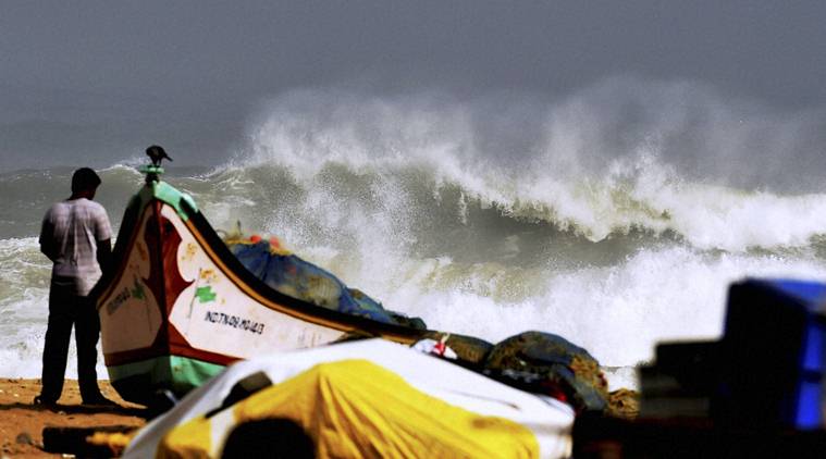
The Cyclonic storm Vardah is centred across west-central and adjoining southwest Bay of Bengal which is 150kms east-northeast of Chennai and 290 kms east-southeast of Nellore, Andhra Pradesh. It is packing winds of 100 kilometers per hour and is first cyclone in the area of Bay of Bengal to attain the force of a hurricane in 2016. The Cyclone so far is of Category 1 strength and is expected to weaken in the coming hours after the rainfall.
It is predicted that the system is likely to move westwards and cross north Tamil Nadu and also coasts of south Andhra Pradesh. The next 36 hours will be intense for south coastal Andhra Pradesh, north coastal Tamil Nadu and Puducherry. It is expected that the tidal wave of about 1 metre height is expected to inundate the low-lying areas of Chennai, Thiruvallur and Kanchipuram districts of Tamil Nadu and Nellore districts of Andhra Pradesh.
District administration has put all the officers on high alert. Various field/nodal officers have been positioned in the field to oversee the preparedness, rescue and relief efforts. Army, Navy, Air-force and Coast Guard have been alerted and put on standby for deployment. Even NDRF, SDRF, Fire and Rescue services have been pre-positioned for meeting any eventuality.