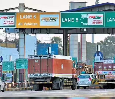
Satellite-Based Toll Collection System in India
Recently, Union Minister of Roads, Transport and Highways Nitin Gadkari announced plans to introduce a satellite-based toll collection system for the country’s highways. This innovative system aims to charge tolls based on the distance travelled by vehicles, directly deducting the amount from users’ bank accounts. The move is expected to reduce toll taxes, streamline journeys, and improve the overall efficiency of India’s highway infrastructure.
Functioning
The proposed system will utilize the global navigation satellite system, including India’s own GAGAN (GPS Aided GEO Augmented Navigation) satellite navigation system, which has an accuracy of approximately 10 meters. An On-Board Unit (OBU) will be installed in vehicles to facilitate accurate mapping and toll calculation.
The system will use digital image processing and software algorithms to log the coordinates of the entire length of the country’s national highways, assign toll rates, and calculate the toll amount based on the distance travelled by each vehicle.
Challenges
The implementation of the satellite-based toll collection system faces several challenges:
- Toll recovery in cases of non-payment or system manipulation
- The need for nationwide implementation of Automatic Number-Plate Recognition (ANPR) systems
- Ensuring data security and privacy
- Enforcing compliance through the use of gantries equipped with CCTV cameras
Integration with FASTags
FASTags, the radio frequency identification-based toll collection system made mandatory by the government on February 16, 2021, will continue to operate alongside the new satellite-based system. The OBUs are expected to complement rather than replace FASTags, offering lower operational costs and enhanced efficiency.
Benefits
The satellite-based toll collection system offers several advantages:
- Elimination of toll plazas, reducing congestion and streamlining the collection process
- Dynamic pricing adjustments to optimize revenue collection
- Flexibility to implement tolling on all road categories
- Addressing issues related to traffic diversion and toll evasion
Additional Facts
- India has the second-largest road network in the world, spanning over 6.3 million kilometers (as of 2023).
- The country’s National Highways, which constitute about 2% of the total road network, carry over 40% of the total traffic.
- The government has been investing heavily in the development of highways and expressways, with plans to expand the network to 2 lakh kilometers by 2025.
The adoption of electronic toll collection systems like FASTags has already reduced congestion at toll plazas and improved revenue collection efficiency. The satellite-based toll collection system is expected to further enhance the efficiency and transparency of the toll collection process, contributing to the overall development of India’s logistics and supply chain sectors.
Month: Current Affairs - March, 2024
Category: Economy & Banking Current Affairs - 2024


