
China launches Gaofen-3 high-resolution radar imaging satellite
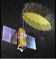
China has successfully launched a new high-resolution Synthetic Aperture Radar (SAR) dubbed as Gaofen-3.
It was launched from the Taiyuan Satellite Launch Center in northern Shanxi Province on the back of a Long March 4C rocket. It was 233rd flight mission by a Long March carrier rocket.
The Gaofen-3 satellite was developed by the China Academy of Space Technology (CAST) and Shanghai Academy of Spaceflight Technology (SAST), under guidance of China Aerospace Science and Technology Corporation (CATC).
Key Facts
- The Gaofen-3 satellite is China’s first low orbit remote sensing satellite. It has lifespan of eight years.
- It will provide high-definition remote sensing data for its users over long periods of time.
- It has 12 imaging modes that will provide high-definition observation satellite is capable of taking wide pictures of earth and photographing detailed scenarios of specific areas.
- The Gaofen-3 satellite is China’s first SAR imaging satellite. It is accurate to one meter in distance and covers the globe with an all-weather 24-hour observation service.
- It will be used for disaster warning, water resource assessments, weather forecasting and the protection of maritime rights.
Background
- China had launched its ambitious Gaofen project in 2013. As part of it Gaofen-1 satellite was launched in April 2013 which can cover the globe in just four days.
- Gaofen-2 satellite was launched into space in August 2014. It is accurate to 0.8 meters in full color and can collect multispectral images of objects 3.2 meters or longer in length.
- Gaofen-4 satellite launched in late 2015. It is China’s first geosynchronous orbit high-definition optical imaging satellite and the world’s most sophisticated satellite.
Related Posts
Month: Current Affairs - August, 2016