MapmyIndia Launched Features to Locate Corona Vaccination Centre
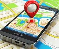
The digital mapping and location-based deep-tech product and platform company, MapmyIndia has launched the targeted maps and nearby search features for its mobile application as well as its official website. This feature will help the Indians to find coronavirus vaccination centres across India.
Highlights
Government of India has also integrated these features into cowin.gov.in which is the official covid-19 vaccination registration portal. This feature would help in guiding the people and connect them to the nearest vaccination centres.
Role of MapmyIndia during COVID-19 Pandemic
Ever since the covid-19 pandemic made its fall in India, MapmyIndia has been geospatially mapping all the corona related places, treatment, testing, isolation centres and all the containment zones in real-time. It has also put all the vaccination centres across India on MapmyIndia maps in order to make critical vaccination effort seamless.
About MapmyIndia
It is an Indian technology company which builds the digital map data, location-based SaaS, telematics services and GIS AI services. This company was established in the year 1992 by Rakesh and Rashmi Verma. It is headquartered at New Delhi. The company is also having regional offices in Mumbai and Bengaluru while its international office is located at the San Francisco Bay Area. The company recently won the “Atmanirbhar App Challenge” for its consumer app called “Move”.
Background
Rakesh and Rashmi Verma had also launched a start-up called C E Info Systems New Delhi in 1992. They later started working on developing a web mapping technology and provide products & services which are needed to enhance the marketing and logistics efficiency.
Projects by MapmyIndia
MapmyIndia took up its first ever project in1993 to develop good quality maps comprising of detailed topography in order to support the marketing and logistics operations of Coca-Cola and Cellular One. In the year 2004, it launched its “Digital Mapping Portal” that provides free, customized and location-based services. Thus, this portal helps in last mile deliveries of the product and services. It also launched a GPS Navigation service called Road Pilot in the year 2010 which comprises the preloaded map for Indian Cities. It has also creating maps of Sri Lanka, Bangladesh, Bhutan and Nepal. It also launched a Covid-19 dashboard in the year 2020 that maps the real time containment zones, Covid testing and treatment centers across the country.
Month: Current Affairs - March, 2021


