
NASA’s ICESat-2 discovers Antarctic Meltwater Lakes
American Space Agency, NASA’s ICESat-2 discovered Antarctic Meltwater Lakes recently.
Background
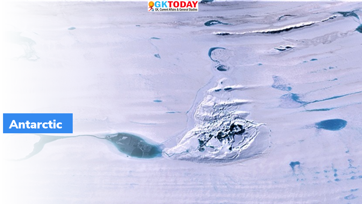
Glaciologist Helen Amanda Fricker had made an astonishing discovery in 2007 and found that, a whole hidden network of interconnected lake is found beneath thick Antarctic ice-shelves. She found that, these lakes actively fill and drain. Presence of meltwater beneath ice sheets was known, but such network of an active water system was a breakthrough. She had used data from NASA’s ICESat. This satellite used laser pulses to measure elevation data for ice, clouds & land.
How ICESat-2 was used to map lakes?
ICESat-2 is the successor of ICESat. It was launched by NASA in 2018. This new satellite can gather elevation data with higher precision. Using data from ICESat 2, Fricker has now discovered two new subglacial meltwater lakes under glacial ice of Antarctica. Network of Lakes were mapped high precision.
Significance of the mapping
These maps will help scientists understand water system in Antarctica. They would be able to figure out how these glacial lakes contribute to ocean water. Using these critical measurements scientists would explain & predict appearance & disappearance of Antarctic lakes. For instance, an enormous lake had disappeared in just three days in Amery Ice shelves of Antarctica. So, scientists can calculate how this is caused by global warming and how these lakes will affect movement of Antarctic glaciers. During this movement, ice sheets suffer cracking, crevassing etc which can be measured using space lasers.
ICESat-2
It stands for “Ice, Cloud, and land Elevation Satellite”. It is a part of NASA’s Earth Observing System for measuring ice sheet elevation and sea ice thickness. It also measures land topography, vegetation characteristics, and clouds. This mission was launched on September 15, 2018 from Vandenberg Air Force Base in California.
Related Posts
Month: Current Affairs - July, 2021